Between Land and Sea

Peter Richter
As an amateur outdoor photographer living in Vienna, I enjoy spending a lot of time in nature and try to share my experiences. I first became familiar with analog black and white photography in my youth, and I was always interested in the whole process from image composition to finalizing the print. Later on I turned to digital techniques and deepend my knowledge in image processing and printing. My work mainly consists of landscape images from Austria and other European countries. I focus on intimate landscape images, first of all trees and forests.
It’s now been more than ten years since my wife and I visited the German island of Sylt for the first time in October 2014. We were immediately taken by this unique landscape. Its exposure to the untamed forces of nature impressed us deeply.
Sylt belongs to the North Frisian Islands and is the northernmost island of Germany. It is well known for the 25-miles sandy beach along the west coast. Due to the exposed situation in the North Sea, there is an ongoing loss of land during storm tides. To the east of Sylt, there is the Wadden Sea, which ranges over to the mainland, which mostly falls dry during low tide. Since 1927, the island has been connected to the mainland by the Hindenburgdamm causeway. It was constructed for rail services only, the trains also transporting vehicles, buses and heavy trucks.
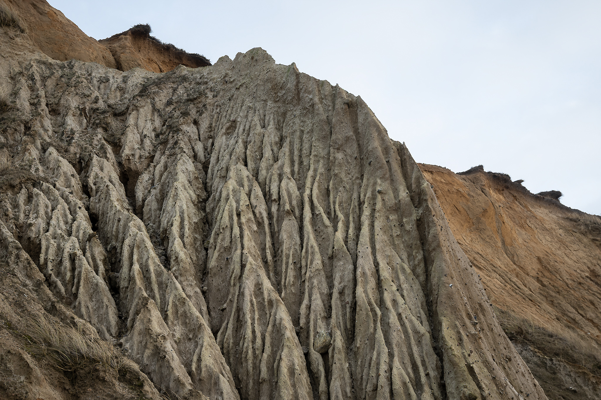
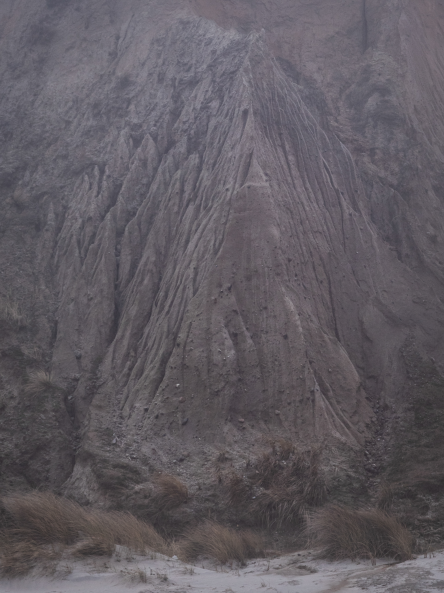
The northern and southern parts of Sylt are built up of sand deposits, while the central part consists of a geestland core, which becomes apparent in the form of the Red Cliff of Wenningstedt in the west. Facing the Wadden Sea in the east, the geestland turns into fertile marshland.
The Wadden Sea has a high biological diversity and is an important area for both breeding and migrating birds. Historically, the coastal regions were often subjected to large floods, resulting in thousands of deaths. Some of these also significantly changed the coastline. Numerous dikes and several causeways have been built. This makes it among the most human-altered habitats on the planet.
Moraines from the older ice ages formed Sylt like the mainland geestland. The sandy core was exposed to a strong current along the island's steep basement when the sea level rose 8000 years ago. The west coast was shifted gradually 6 miles eastward, while the island extended to the north and south. Beyond this, dunes drifted to the east by sand shifts and threatened settlements and arable land. Sand drifts were stopped partially by the planting of marram grass.
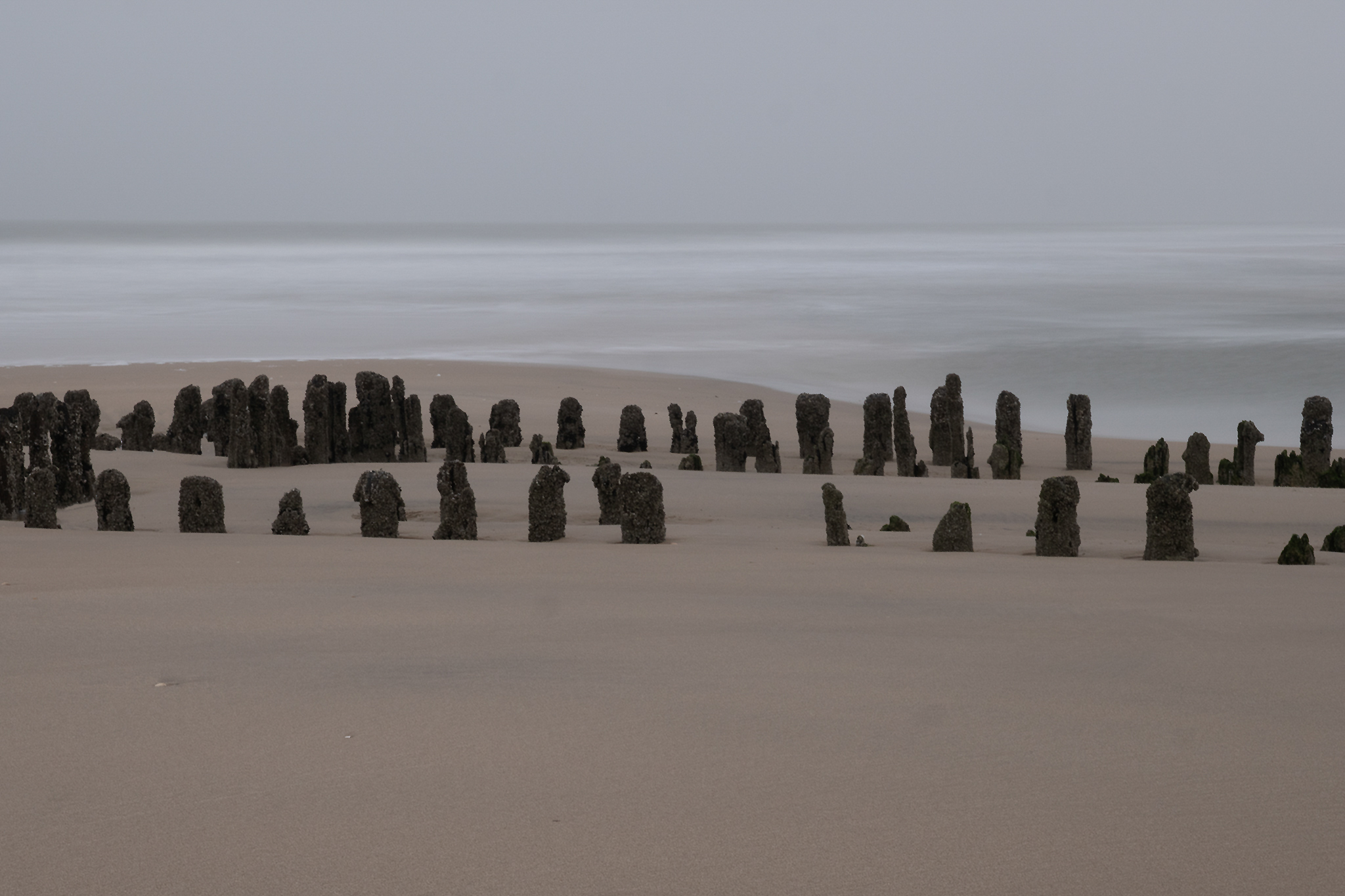
Sylt has repeatedly been endangered by severe storms to the point of breaking in two. The part of the island near the village of Rantum, which is only 500 yards wide, is especially threatened. Dating back to the early 19th century, groynes of wooden poles were constructed as a measure of protection against erosion. The constructions did not have the desired effect. The only effective means so far has been flushing sand on the shore, which began in the 1970s.
Being aware of the history and possible fate of the island, my wife and I stood in awe facing the forces of nature when we felt the sand of the western beach underneath our feet for the first time. We have never seen Sylt during the tourist season in summer. Instead, our first impression was a quiet period in autumn. This gave us the opportunity to explore the island hiking for hours on our own along the dunes, the Wadden Sea and especially the exposed west coast.
The second time we visited the island was at the turn of the following year. No fireworks took place at midnight, as they are forbidden due to the thatched roofs. Instead, people walked silently to the beach, accompanied by the ringing of church bells. The sea and waves were invisible in the darkness. We stood at the water’s edge, almost devoutly listening to the roar of the surf, feeling the wind and smelling the salty air.
After that, we returned during winter months twice again, and once also in spring, developing a growing closeness to this small part of the world.
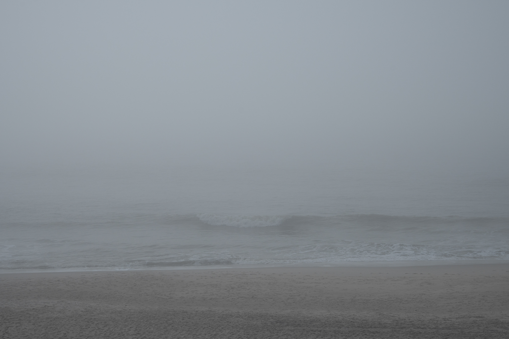
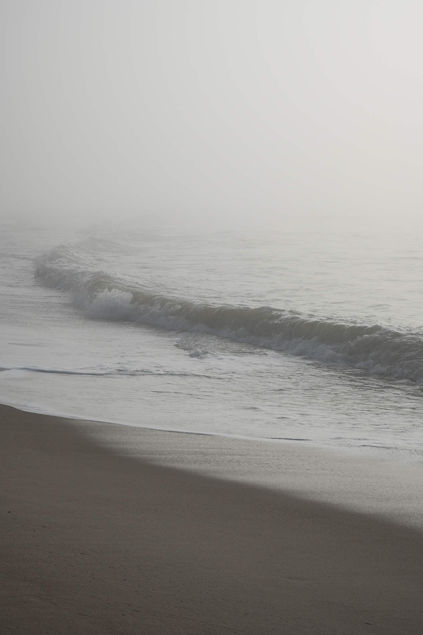
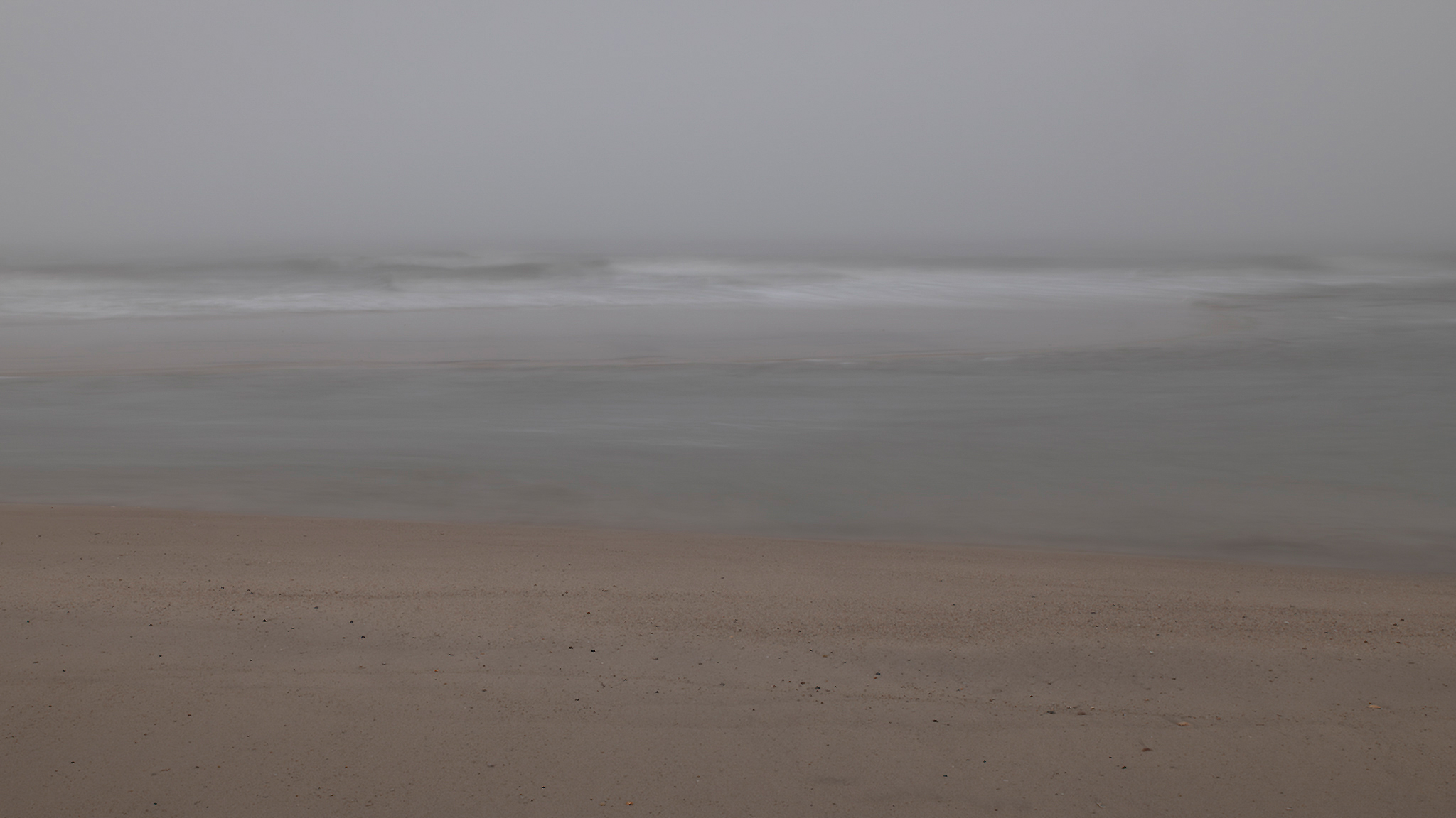
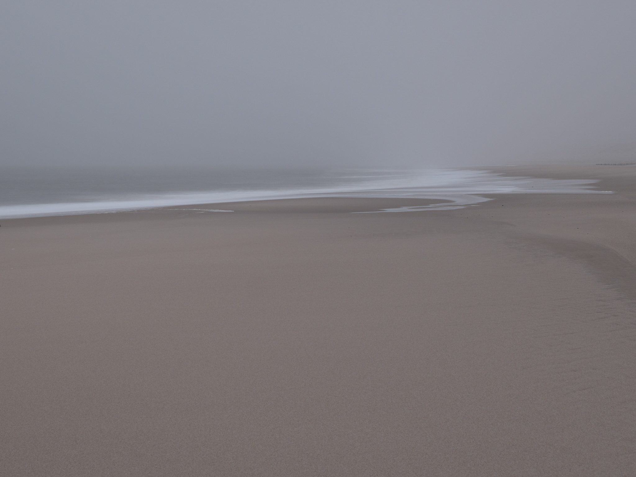
In 2025, we arrived at the end of February. What we had not yet experienced before was a week of persistent fog. Visibility was sometimes only as far as 50 or 100 yards. The sea, sky and land seemed to merge. Making photographs under these particular conditions, it appeared appropriate to me to make also use of long time exposures in order to emphasize this phenomenon of visual merging. Most of he time it was not even possible to estimate the dimensions of the island due to the fog.
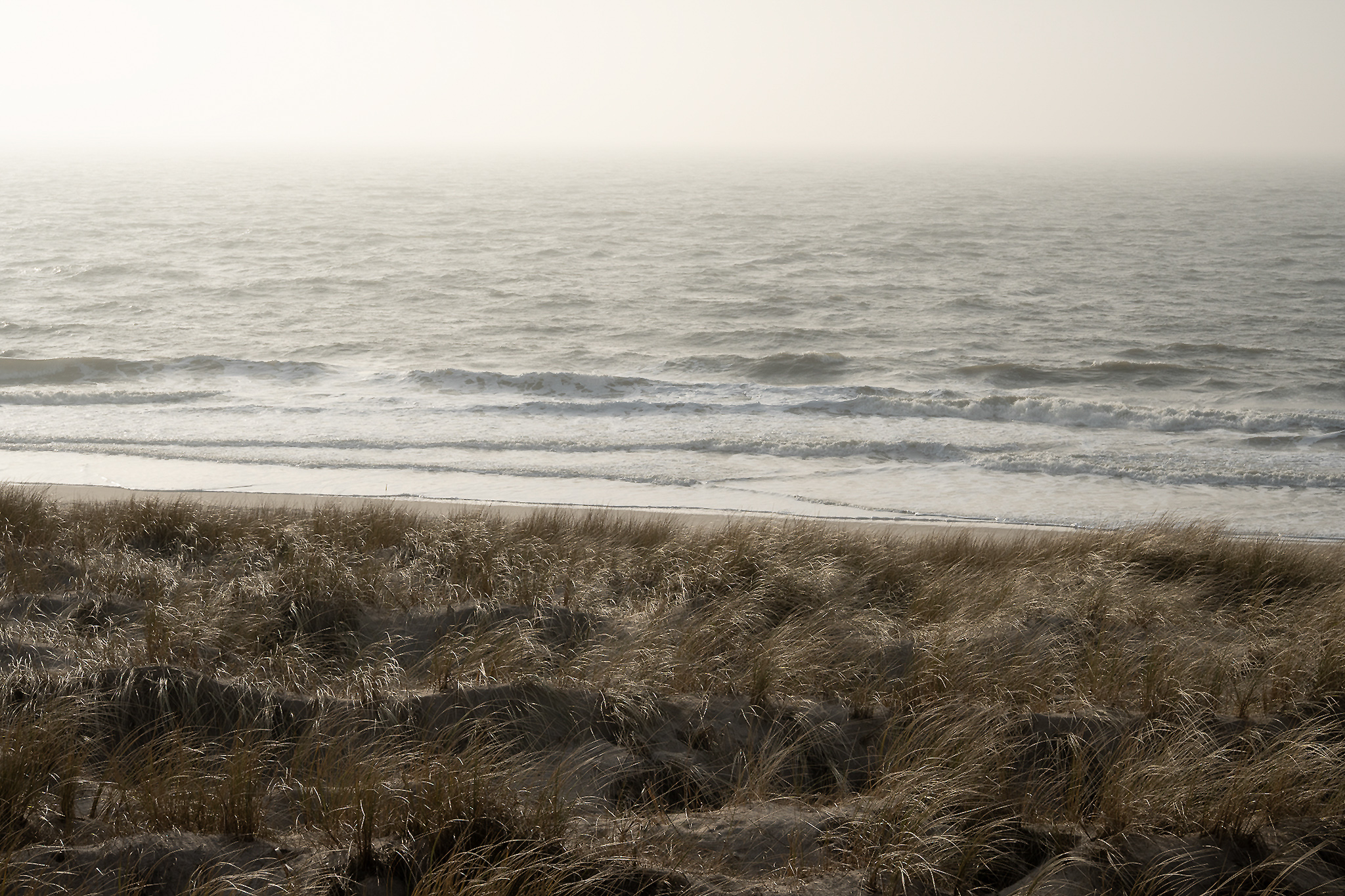
Sylt with its diverse facets – the rough sea at the west, the unstable dunes and the ever changing world of intertidal ecosystem in the east – seemed to be summarized in these images for me. Even the Red Cliff appeared only sketchy in such moments, although we were facing it at a distance of only 50 yards.
The mental and physical feel of vastness when walking along the water’s edge of Sylt is engraved in our minds. Maybe some of the images are able to convey this state of mind.