
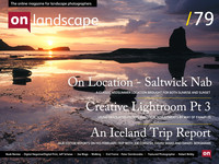
Location Guide

Tim Parkin
Tim Parkin is a landscape photographer living in Scotland who co-founded On Landscape magazine. Alongside his photography and writing he also co-founded the Natural Landscape Photography Awards, runs a film scanning business and is a judge for other international landscape and nature competitions.
After a bit of a lean period in terms of my own photography I’ve had the pleasure of going out every week for the last four weeks. Every one of those weeks has been to the same location but in many ways that has made it more interesting. Apologies for the delay in getting the latest issue complete as we have spent some time getting the 360 location guide working again (why do software developers insist on changing things!). It’s not coincidental that we had the recent meeting at our colleague David Tolcher’s house in Robin Hood’s Bay and that we made a ‘trip report’ of sorts out of it. We thought you might be interested in learning a little more about the location and thinking about what you might have made of it had you been there. And so - in a roundabout way - I’m introducing a new location guide.
If you take a look at a map of Whitby, you’ll see just to the right hand side a sandy bay simply called Saltwick. It’s not really promoted as an attraction and to get their you need to drive up a private caravan park entry road and park up right outside their gates. To get down to the beach you need to walk into the caravan site and then follow a path down a fairly steep slope (thankfully it’s been maintained recently and could previously be described as more of a mud chute than a path). I’ve marked this path in green, as well as other rights of way, on the map below (bare in mind that the map is from 1875 and things have changed a little since then - however it’s all I can get without massive fees from Ordnance Survey).
I’ve marked the sandy part of the beach in orange. Car parking is marked with the P. If you click on the image below you'll get a wider view including Saltwick Nab (right click here if you want to see this on a new tab or download).