

Landscapes of legacy

Terry Ward
Terry Ward took his first picture in 1977. Covering a wide range of topics over the years from landscapes in the Peak District to street photography in Cornwall and London.
He likes to work in project form taking a subject and focusing on
a particular important aspect. His solo work Mill Roads Finest Hour,
Vista and Fenlands have all been exhibited and he has contributed to
group shows.
He is a published author and photobook creator. With Vista
being his first. He also publishes historical and cultural publications.
He is active on social media and has conducted many lectures about
photography and history in the south east of England over the past
few years.
Ever since I started shooting pictures as a kid of the Peak District back in the late 1970’s during a scout camp, I have been interested in the world around me and set about creating landscape pictures. I am now 51 and decided to use the photographic medium of Landscape to create an ongoing project called ‘Echoes’. Now I am getting a little older I am interested in the whole question of legacy and time. Whilst compiling my photo book Vista back in 2015 which highlighted the struggle between man and nature in the context of the English countryside, it dawned on me that by observing these manmade and natural changes over time a record could be made to enhance my understanding of what time is. I started makes images for Echoes early last year a few months before my milestone fiftieth birthday and focused on the questions of legacy and ageing, evolving the Vista narrative and extended it to many selecting sites in the North Essex countryside, some of which were used in the Vista project.
I have based my long term case studies near the market town of Saffron Walden North Essex, mainly concentrating on areas near the hamlet of Little Walden.
The town is within the district of Uttlesford and it is mainly an open field arable setup; with various small fields and wooded sites that shows elements of the former landscape. I focused on areas that have direct human connections which have all but disappeared, but somehow hold on to their past spirit.
The project's images were created over an eighteen month period, when exhibited together the pictures start to show subtle changes that reflect not only the changing seasons and environments but also changes in attitude to the countryside. With this approach, I now started using different colour palettes and a tripod which affects the way my images were taken and planned. It seems to slow the whole photographic process down. I decided to photograph in all available lighting conditions and not stick to the traditional golden hour or days when the light was very flat. This made for an interesting take on the subject being photographed.
As time passes the landscape around us changes this reflects subtle environmental, historical effects and influences. The wind, rain and sun also leave their mark as do passing policies on land use and crop production. Throughout history massive changes such as the nineteenth century Enclosure acts and the ripping out the hedgerows and cutting down coppices and ancient woods, this has left our land poorer environmentally and aesthetically.
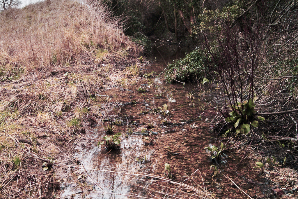
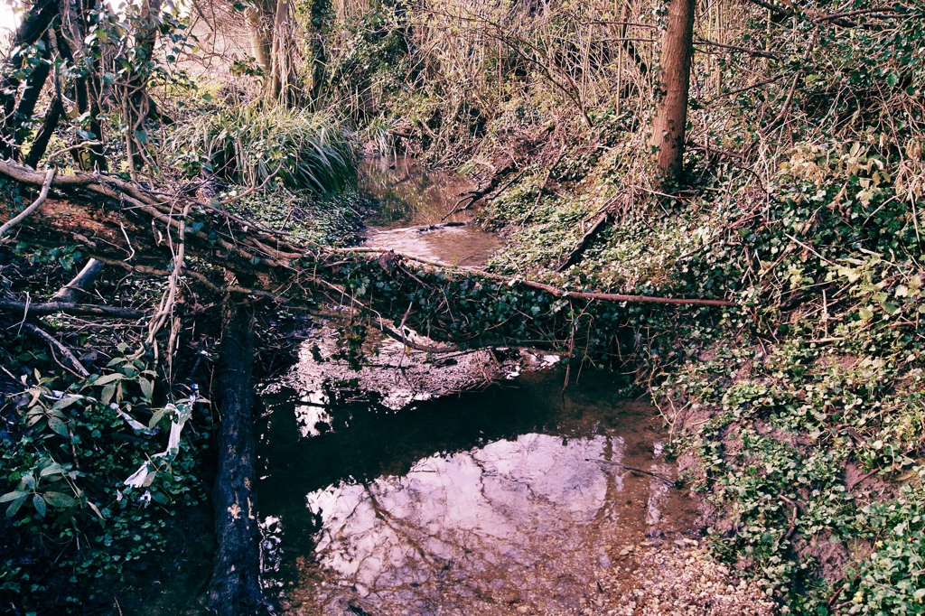
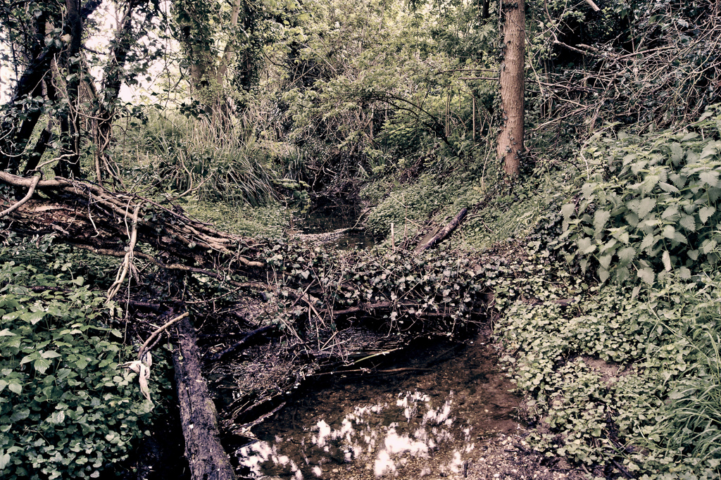
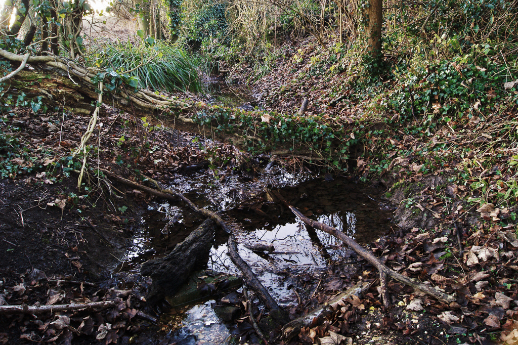
The Madgate Slade or Kings Ditch Saffron Walden Essex
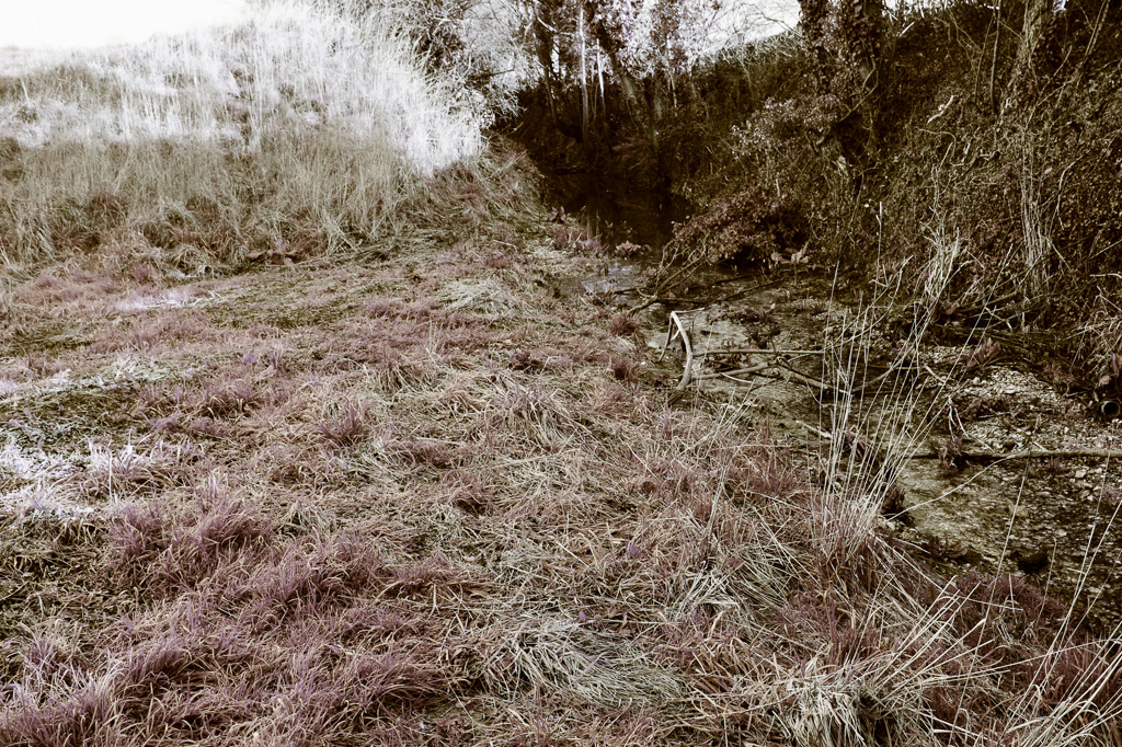
One of the first areas I focused on is The Madgate Slade watercourse in Saffron Walden. Though dry in summer, at times the steam can well up and flood the surrounding lands. It starts its life as a network of flood ditches, moving south and fusing together to create a chalk stream meandering its way through the intensively farmed fields, culverted through parts of Saffron Walden, it then ends its days at the Cam after running through the formal Audley End Estate. The stream has two sides to it, in summer the dry chalk bed is home to many items of flotsam and jetsam discarded in the watercourse, shopping trolleys, doors and road signs have all been found in its environs.
But once any large amount of rain falls into the stream it swells up and routinely floods the local area. Hot spots include a bridged former ford and local roads. During a bad flood recently the water rose up and reached the door of a local farm nearly 500 yards away. Even the local pub some distance away from the main body of water has been affected by flooding in extreme cases. This can radically change and mould the Slade’s environs. One of the featured Slade pictures highlights flooding of the area; it also captures the changing dynamic of flora. The surrounding area was once an arable field but after the development of the nearby area the field was re-landscaped and it seems that the mound in the background of the pictures is part of a flood trap.
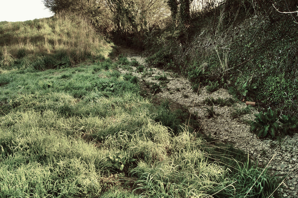
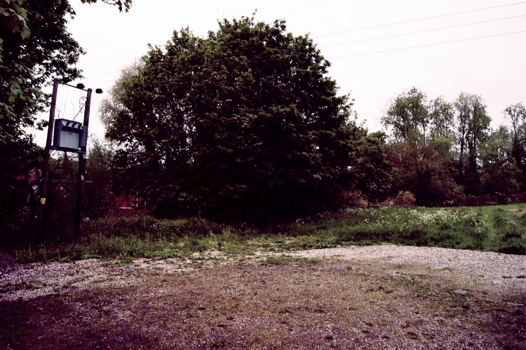
Down or Water Lane Little Walden Essex
Old footpaths are another massive source of inspiration for me. They would have been used as direct routes to work by many labourers in the past, unaware that all those years later a public footpath network would be established along the same pathways they used and that many people would follow in their footsteps.
But instead of travelling to work the pathways main function now is leisure pursuits such as dog walking or jogging. Researching local maps some dating back to 1758 I have located many footpaths between old farms and villages that in turn split down to service individual properties so creating a complex network of twitchels and tracks. One such path is Down or Water Lane which cuts through the local countryside from Hall Farm in the village, it snaked its way southeast for about a mile following the Slade stream to connect with a few small properties in a field named as Margery Roys in 1758.
The properties are now long gone, but the connecting pathway survives as a public footpath. This was probably used every day by the occupants of the lost properties and would have been massively important as a lifeline to work and the village. The public footpath is now used by many dog walkers and cyclists, utilising the route on a regular basis and keeping its original use intact yet unaware of its past importance. The area is prone to flooding and due to the surrounding intensive agriculture, many nutrients are washed off of the fields encouraging nettle growth. The images shown give a good indication of the flora present and the ebb and flow of the stream that runs through the area.
The Meadows Little Walden Essex
Meadows by their very nature are disappearing places in this era of intensive farming. Many fields around the surviving meadows are intensively farmed, following a pattern that is popular all over the north of Essex. The main crops produced in the area are now wheat or oilseed rape, historically the local grass meadows that were used for haymaking or animal grazing are now not required due to modern farming practices. Some grassland has been reintroduced into Essex via recent government schemes as wildlife buffers, and where a scheme has been adopted locally the results are dramatic.
The meadow that I have focused on is regularly flooded by the adjacent Slade stream; this probably contributes to why this piece of land has been left to grass. This meadow has had many types of wildflowers present and is rich in butterflies and other wildlife. I have documented this area due to its fragile nature, as it is surrounded by either intensive farming or water; not knowing whether it will be ploughed up in the future gives it a vulnerable quality. The featured meadow is close to a field formally named as Water Meadow which is present on the 1758 map of Butlers Farm.
I use the name The Meadows to describe the general area. As in many of the areas I have studied I have discovered that there were tenements adjacent, this is also the case with this meadow. A tenement is shown in 1758 by the field and the spirit of this home can be felt. The featured meadow may have been used as a playground or as working the land and would have been part of the view from the tenement. The building’s connection to this piece of land may be historical but it is still there in spirit. In the summer the grasses and wildflowers grow to waist height and impromptu paths are carved out by dog walkers and visitors to the nearby small church and village hall.
I revisit these places throughout the year reflecting the change and at times their former uses... This, in turn, creates a legacy for these areas through photographs; the longer the area is studied the stronger its legacy is reflected. The images are deliberately shot in a quiet and leisurely manner. The plates are all in colour as to reflect the subtle light changes that are on display. The flora adds to the colour palette and makes an important contribution to the feeling of the body of work. I use the fairly basic Lightbox or Picasa programmes for post processing, the software is great for controlling the feel of the light and colour in the images. I build on the original concept or idea and distil what I am trying to say rather than let the software control the work.
As humans have controlled and moulded the landscape over the years, social and historical traits show themselves. My work encapsulates this fine balance between man, nature and time in the thought provoking landscapes captured during this project. In the future will continue with the project and carry on documenting these areas over the next few years.
Do you have a project that you are interested in writing an article about, then get in touch. We're looking for contributions for our forthcoming issues in 2018.