
An innovative project run by the Landscape Group of the Royal Photographic Society.

Mark Reeves
ARPS is self-taught photographer now living in North West England. Having grown up in Fife, he lived for many years in London before spending five years travelling around England with his partner on a canal boat and then settling to live on the coast of the Wirral. His work has been exhibited in Waterloo Station in London, in the World Museum in Liverpool and various galleries in the North West. As well as being active on climate change within the RPS he is also the events manager for the Society’s specialist landscape group. Mark also gives regular talks to camera clubs and teaches photography on a part-time basis.
52N 0W, Hertfordshire, Diana Buzoianu
The project “By Degrees” was conceived in 2021 when being a bit of a map nerd, I found myself one day pondering the places where lines of latitude and longitude intersect. I had never knowingly been to such a place, so was intrigued to find out where was the closest to my home. Having located it – some 43 miles to the south – I then wondered where its next closest neighbours were. Perhaps inevitably, this led me to plotting all the intersections on a map of the UK and then considering the feasibility of photographing them all. I quickly realised that it would involve a huge amount of travelling and that it would be a daft idea to attempt it alone. But why not involve others? I took my idea to the RPS Landscape Group committee as a proposal, and so By Degrees was born!
Getting the project off the ground involved firstly working out where all the intersections are and plotting them on a map so that people could easily identify their nearest ones. I figured that people were more likely to get involved if they could relate abstract coordinates to a place that they knew. The mapping wasn't too difficult as you can just type, say, "53N 2W" into Google Maps, and it will show you the exact location.
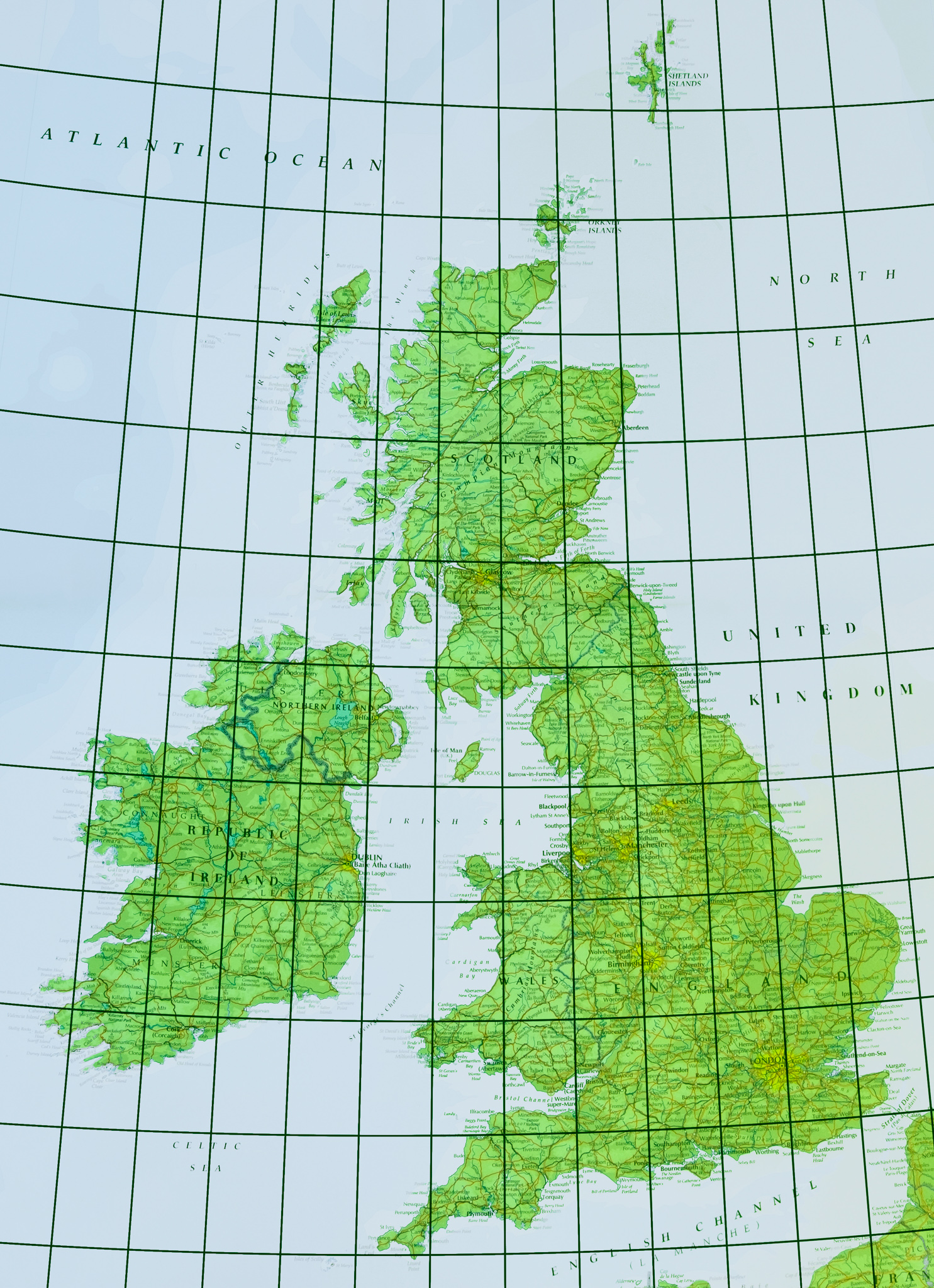
The lines of latitude and longitude intersecting over the UK and Ireland
It turned out that there are 34 places where lines of latitude and longitude intersect over land in the UK, and I was really pleased to find that people volunteered for every intersection. The project brief gave participants the choice of photographing either the view from their chosen intersection or a view with the intersection in the frame.
From the outset, we planned a special edition of the landscape group's printed magazine and so anticipated that there would need to be a process for selecting which images should be published in cases where several photographers photographed at the same locations. To achieve this, we established a selection panel comprising RPS members Simon Hill, Hon.FRPS and Joe Cornish, Hon.FRPS, Vanda Ralevska (regular judge for Landscape Photographer of the Year) and Nigel Clifford FRGS, president of the Royal Geographical Society.
Inevitably, of course, I was keen to take part myself and so I photographed the two intersections closest to my home and also two others that I pass regularly when visiting my family in central Scotland. What I very quickly learned through my own participation was just how difficult it can be to make a decent image when the location is just a seemingly random spot on a map! Challenges that participants had to address included not only uninspiring locations but also getting access to private land and getting to some pretty remote places.
One of my personal favourite images was Ann Miles’ stunning panorama of a field of crops (chard?), showing that with a bit of inventiveness, even a seemingly endless flat landscape can be made engaging.
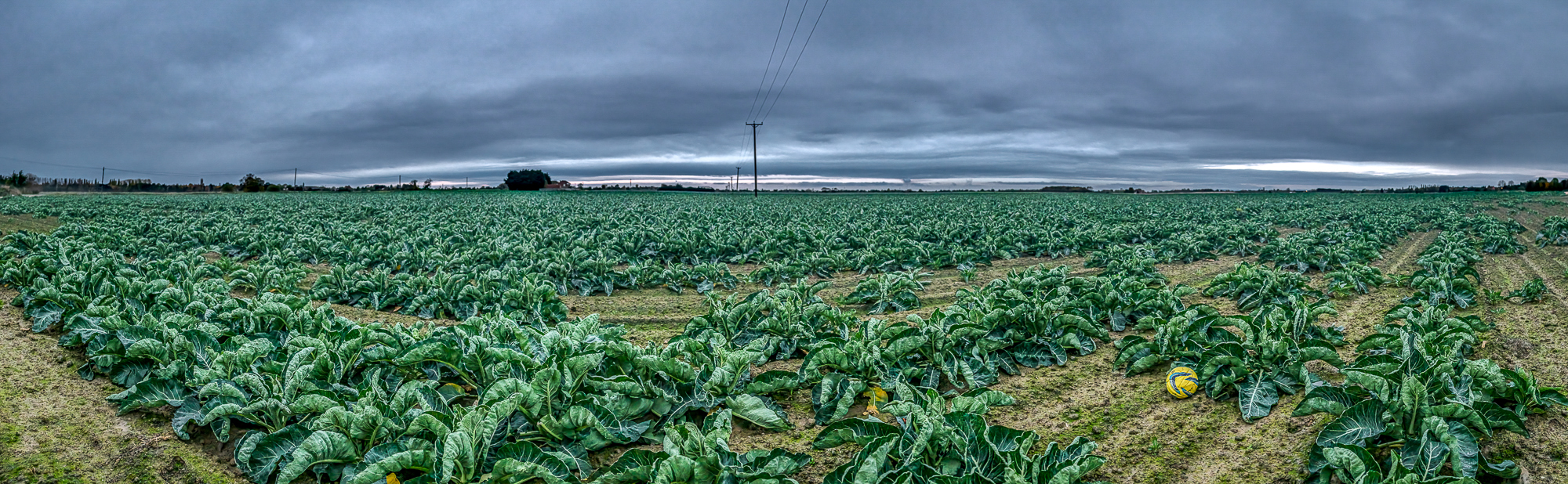
53N 0W, Lincolnshire, Ann Miles
I also have to acknowledge the efforts that some participants went to in order to get their images. Jean Robson needed a 7km cycle up a dirt road, then a climb up and over a col covered in deep heather and finally a plod across a bog in order to get to the intersection at 57oN 4oW to take this image of the Monadhliath hills.
57N 4W, Dumfries & Galloway, Jean Robson
As the deadline for image submissions approached, it began to look likely that nobody was going to photograph at a couple of intersections in the Highlands (57oN 3oW in Aberdeenshire and 57oN 5oW in Assynt in the Highlands). Unsurprisingly, these were the two most remote locations, requiring several miles of tramping across heather moorland on a compass bearing. Rather than leave these intersections unphotographed, another landscape group committee colleague and I set off to photograph them ourselves. Whilst heather moorlands drying up because of summer droughts is most definitely not something to be celebrated, it did mean that this final challenge was slightly less arduous than it could have been. And so it was, in September 2022, that the project was completed.
All images submitted were subsequently uploaded to an online gallery which can be viewed here: https://rps.org/groups/landscape/projects/by-degrees/gallery.
As far as I am aware, such a project has never been undertaken before, and we believe that it is, therefore, unique. Feedback from participants was really enthusiastic, with people often saying how much they had enjoyed the challenge of photographing “odd” locations!
A Selection of Submissions
The following is a curated selection of images from the project. All captions are from the photographers.
53N 0, Lincolnshire, Ann Miles
My exact location was 53degrees 0 minutes 51.16 seconds North/ 0 degrees 0 minutes 1.57 seconds West. I am facing West so panorama covers from S to N. Meridian which was approximately 1 km south of my location. The intersection is in the direction of the far left of my scene.
55N 4W, Dumfries & Galloway, Jean Robson
Taken from about 100 meters from the intersection, because the farmer advised against entering the field with a bull in it. Taken looking in a SSE direction across the intersection.
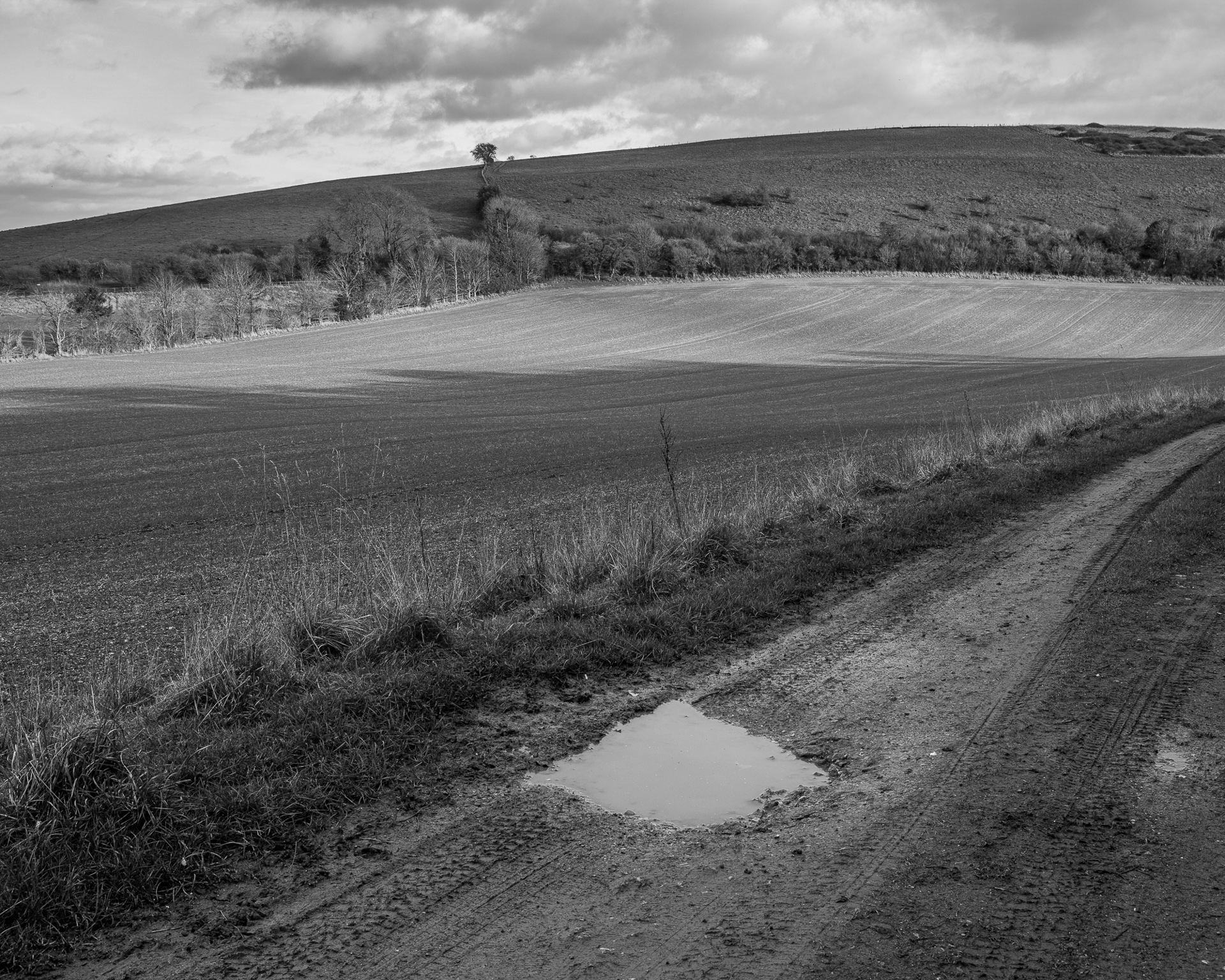
51N 2W, Wiltshire, Richard Draper
The puddle arrow points to the middle of the field where the intersection of 51N 2W lies. I was about 80 metres from the point at 50°59'58" N 2°00'02" W and at 155 metres altitude. I was facing east on 30th January 2022 as the winter sun was close to setting. This is a lovely part of Cranborne Chase at the southern end of Wiltshire close to the intersection with Hampshire and Dorset. The nearest village is Bowerchalke, where the river Chalke rises and flows into the nearby River Ebble.

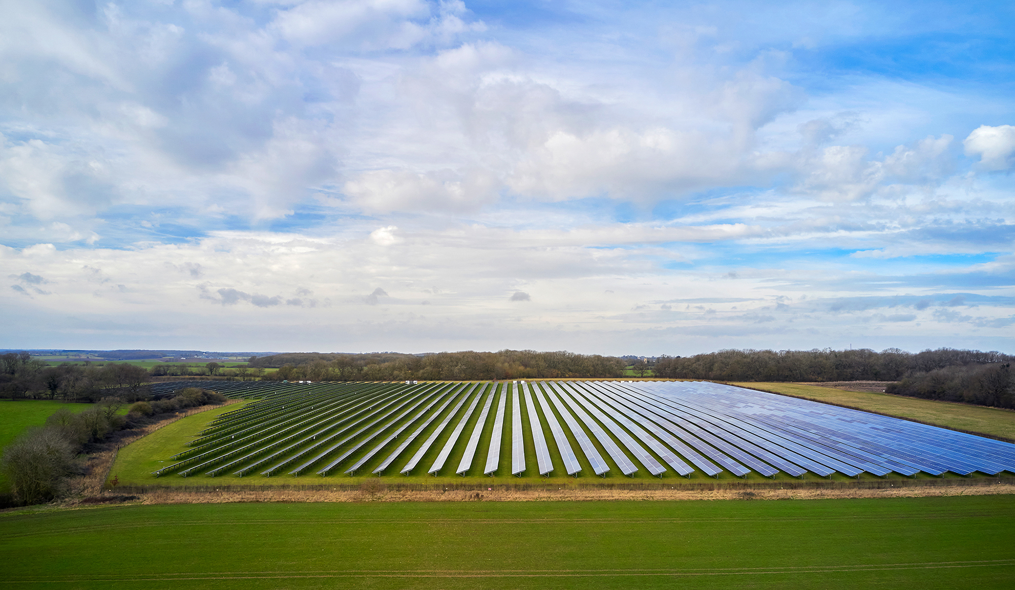
52N 0W, Hertfordshire, Diana Buzoianu
This point is in the middle of a field of solar farm and it shows a wonderful juxtaposition between nature and the creative minds of humans to harness clean energy.
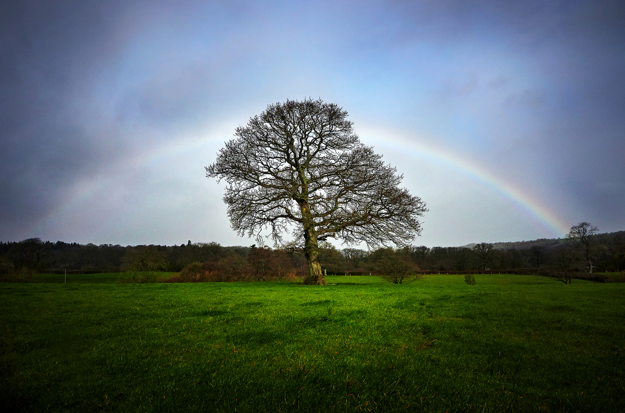
52N 0, Hertfordshire, Diana Buzoianu
I couldn’t pick a better time for photographing this coordinates ..the storm Eunice was just approaching. I had my vision of capturing the image of this golden oak tree from above from my drone but the storm made it definitely impossible to fly. As I was looking for other ways of capturing the point, a beautiful rainbow was just beginning to shine through the heavy grey clouds of rain. Just for a few seconds a stunning view of the tree enveloped by the rainbow appeared. That was definitely more than I could ask for.. This oak tree is right on the coordinates 52N.3W and stands tall in the middle of a field in the village of Michaelchurch Escley in Herefordshire.
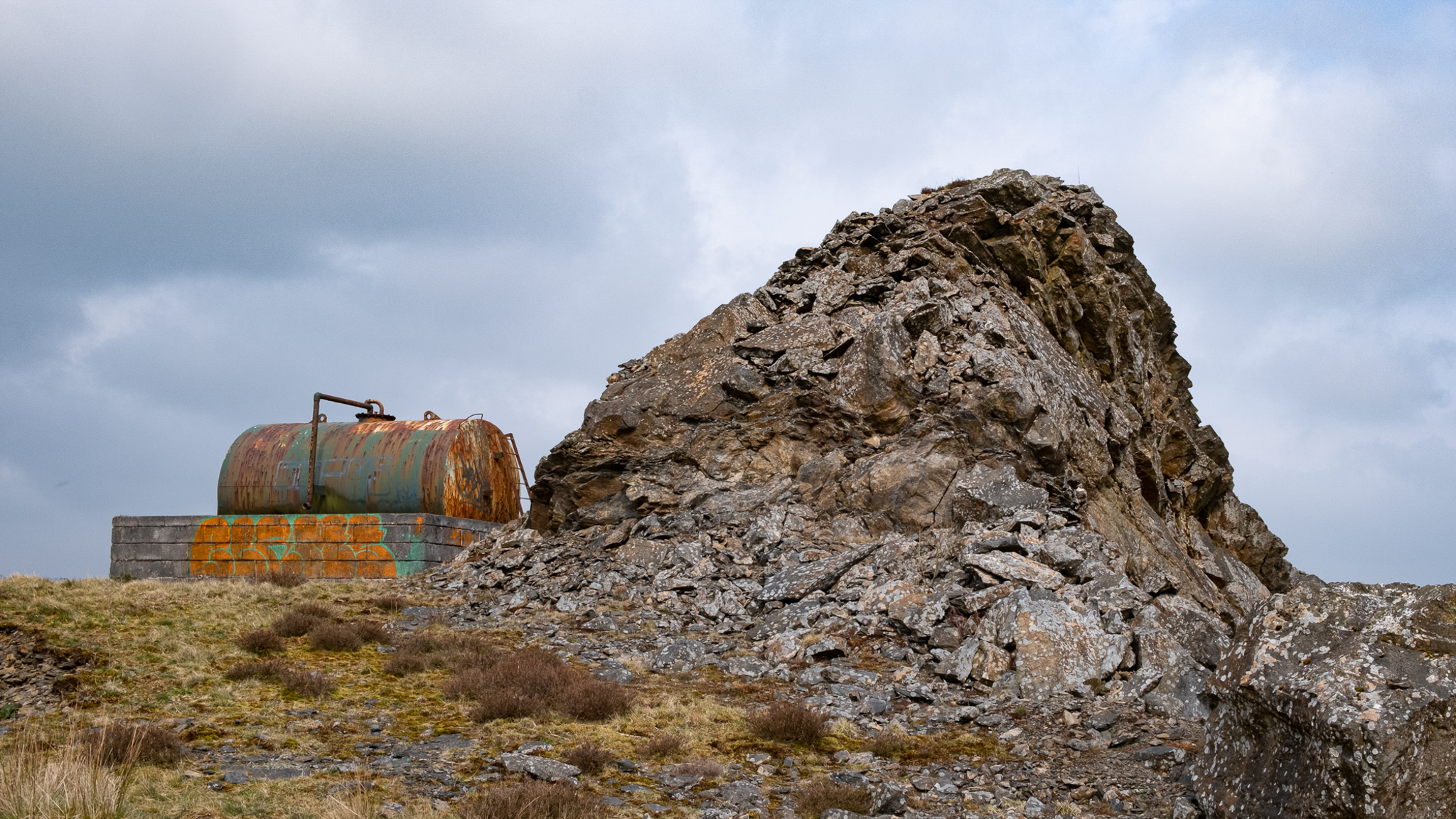
52N 4W Carmarthenshire, Neil Purcell
52N 4W, is on a site adjacent to the B4337, at Dinas Quarry, Pen y Ddinas, near Llansawel in Carmarthenshire.
The hill of Pen Dinas was an area of unimproved pasture, known locally as 'the Warren’. Once upon time, there were the remains of a summer-house 'within some sort of ancient encampment' (Notebook on Carmarthenshire 1804-10). It is probable that the 'ancient encampment' was a later prehistoric type hillfort, which are otherwise scarce in the locality.
The remains of the summer house, or possibly a prospect tower, were said to have been part of the nearby Edwinsford estate.
The site, now owned by Tarmac, is abandoned, having closed down in the late 1980’s. When operational, it mostly produced granite grit for road construction, as well as a surprising amount of quartz crystal.
The exact intersection is inaccessible, buried beneath deep brambles and bracken. Facing WNW, I opted for this shot on the topmost part of the site, which is approximately 300 metres north of the intersection, and which speaks a little of the history and nature of the place and the people who once worked there.
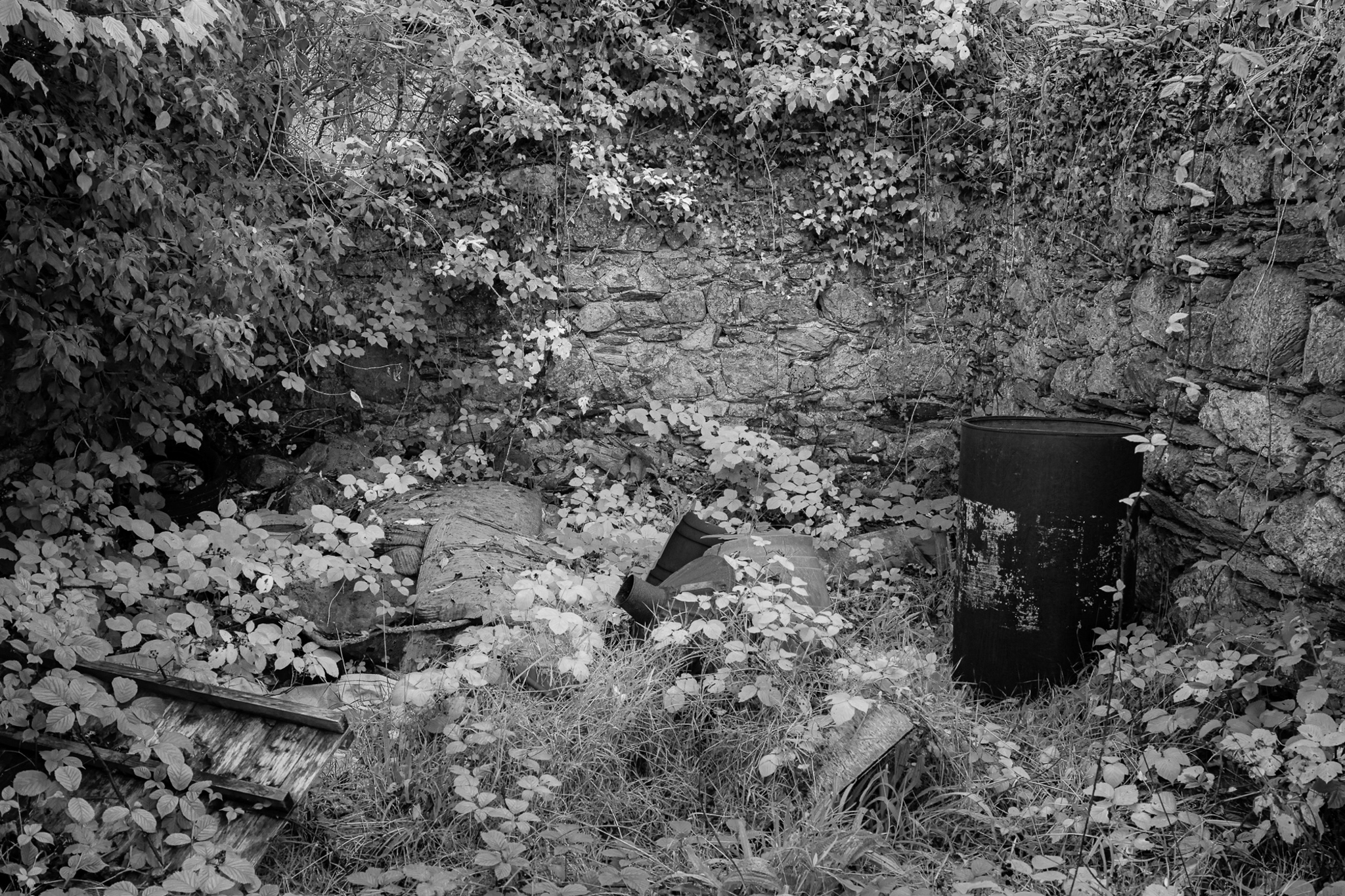
52N 5W, Pembrokeshire, Michael Cooper
This intersection point is located in Dyffryn, Goodwick, Pembrokeshire. The actual intersection point is at the back of this abandoned ruinous old building, to the rear of this wall is dense impenetrable scrub on private land. I am standing approximately 5-6 m NE of the actual intersection point facing roughly SW
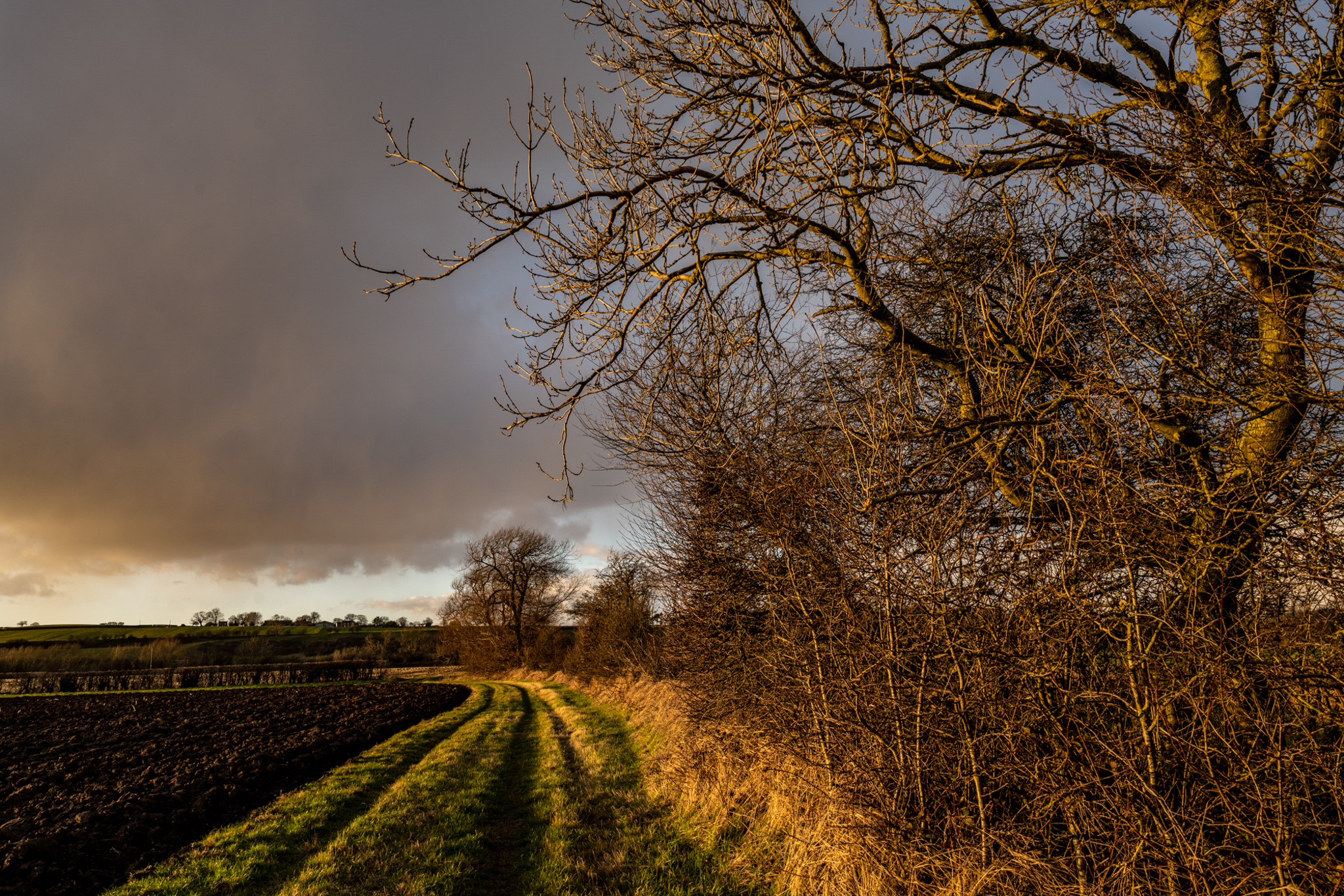
53N 1W, Nottinghamshire, Kevin Gibbin
Looking approximately north-north-west with Cocker Beck on my right, the intersection is on the left of the image just in front of the hedgerow.
53N 4W, Gwynedd, Saul Richmond Huck
The intersection of 53N 4W is alongside one of the Diffwys lakes in the Moelwyns in Snowdonia. Having climbed as far as the exact location it seemed a shame not to climb a bit further to elevate myself above and look back over the intersection to show it in its storm-beaten surroundings. The image was taken at 53°00'10.0"N 3°59'50.0"W. The intersection is at the left-hand side of the picture 360m away and is located underneath the left-most limb of the left-hand lake. The vista is looking southwest over the Croesor Valley towards Porthmadog with the slopes of Cnicht on the right.
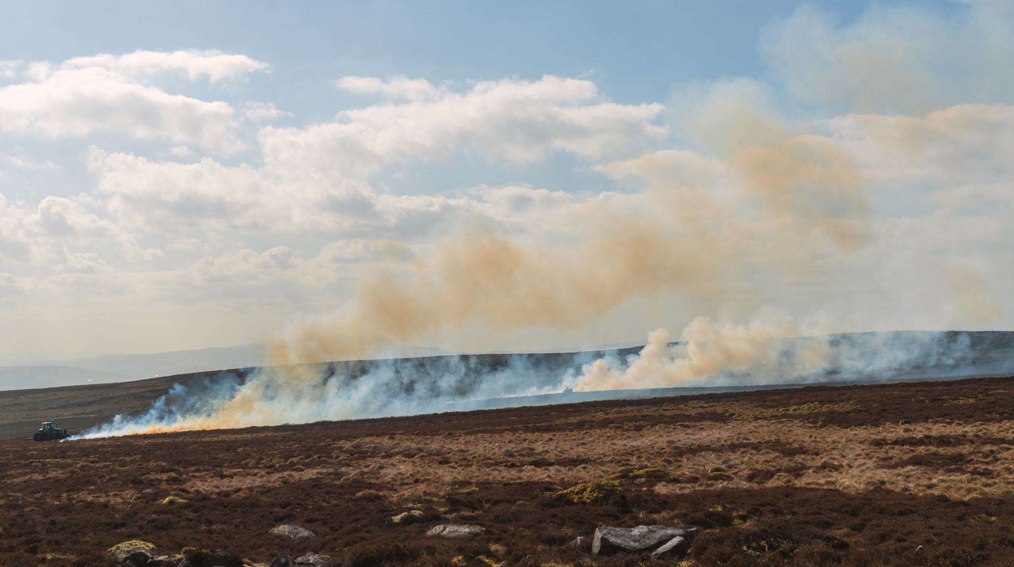
54N 2W, Yorkshire, John Foster
Burning heather on Barden Moor at 54N. 2W. My exact location was 54.00341 N, 1.99263 W. I was facing SSW and I was around 300 yards from the intersection. I think the intersection is approximately where the tractor is, to the extreme left of the shot. The heather burners didn’t want me to come any closer.
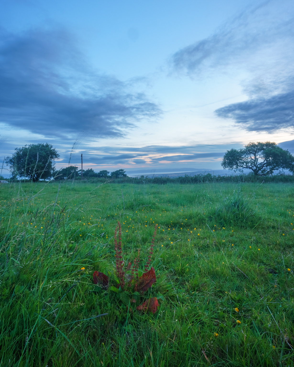
55N 7W Co. Derry, Robin Taylor-Hunt
The intersection point sits within a pasture field, overlooking an area of farmland that lies in between Lough Foyle to the north-west and the striking skyline of Binevinagh to the north-east. However, on the morning I was there the visibility and light was not too exciting, and so I ended up going for a close-up of the intersection point itself - this dried out old dock plant within the grass field.
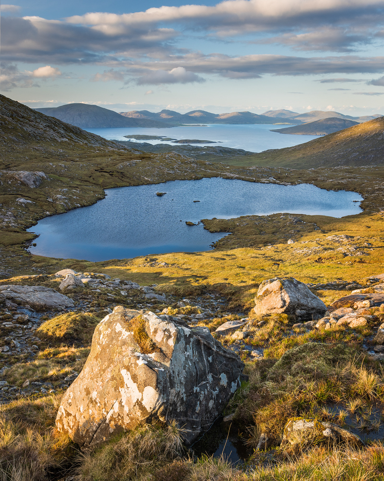
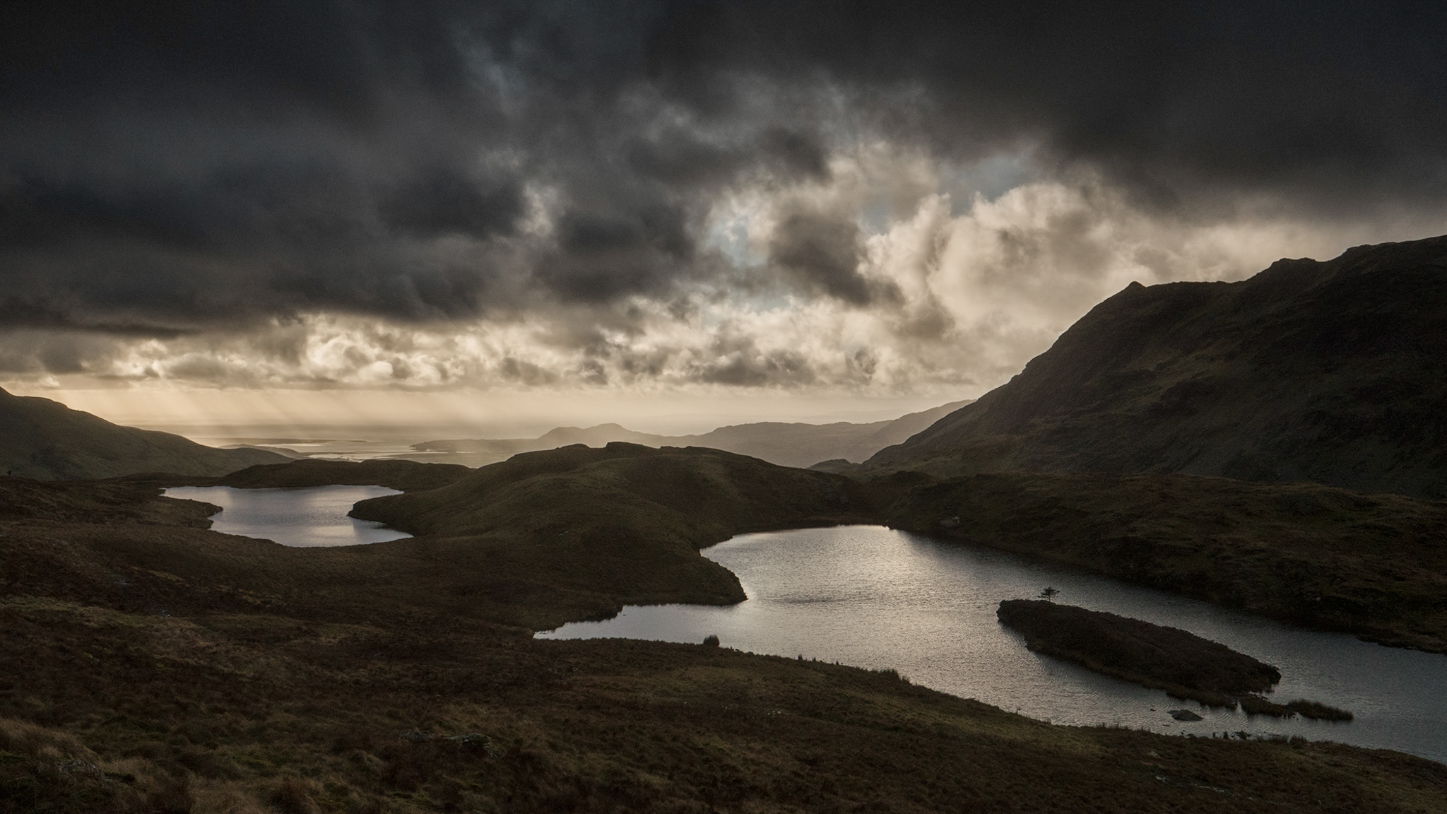
58N 7W, Isle of Harris, Alex Nail
58N 7W on Harris is one of the most scenic latitude and longitude intersections in the whole country. I camped at the spot overnight with my wife and our dog at the end of May hoping for a sunset but instead finding overcast conditions and an icy northerly wind. I was up at 4.30am the following morning to find clear skies and I made my way to the northern side of Loch Braigh Bheagarais to align the loch with the distant view of the Harris hills and Luskentyre. This photo was taken at 58°00’05”N 7”00’09”W. The true intersection lies just 300m from this point, on the far left edge of the image, but ultimately this majestic view was too much to pass up!
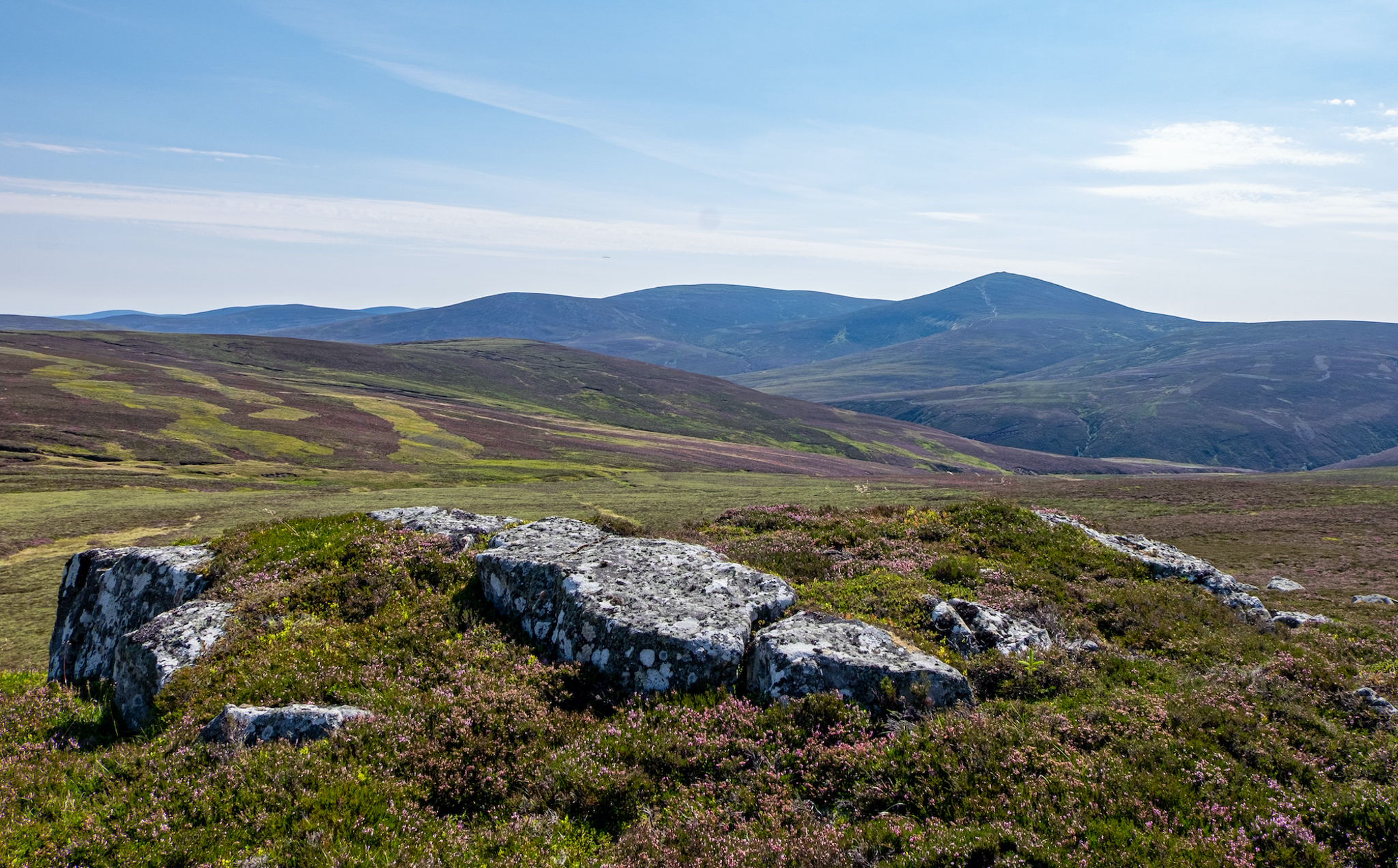
57N 3W Aberdeenshire, John Stewart
The intersection is a 5 mile walk from Ballater. I chose a very warm day with thunderstorms predicted. It is situated near a grouse moor so had to choose a Sunday when the grouse get a day off being shot. I am about 200 yards from the point looking south east towards Mount Keen which is the most Easterly Munro (over 300 feet). Luckily the ground was very dry as this area is usually a bog. The intersection is more-or-less central in the frame in the lower ground behind the foreground rocks.

57N 3W Aberdeenshire, Colin Balfour
Taken from the intersection point looking south-southeast towards Mount Keen (939m) which is the most easterly Munro.
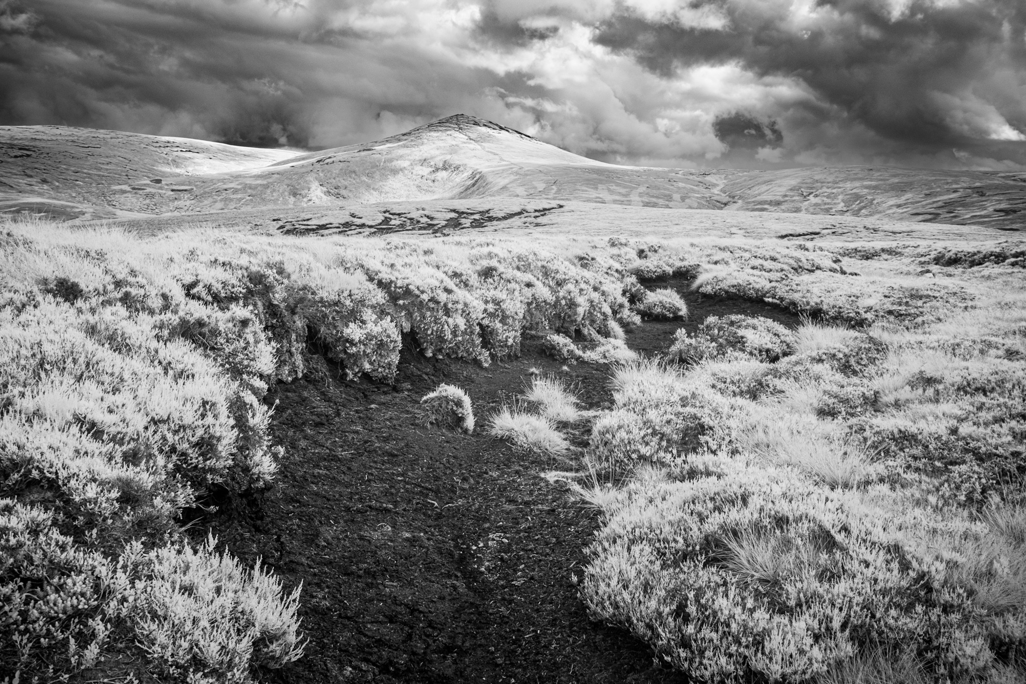
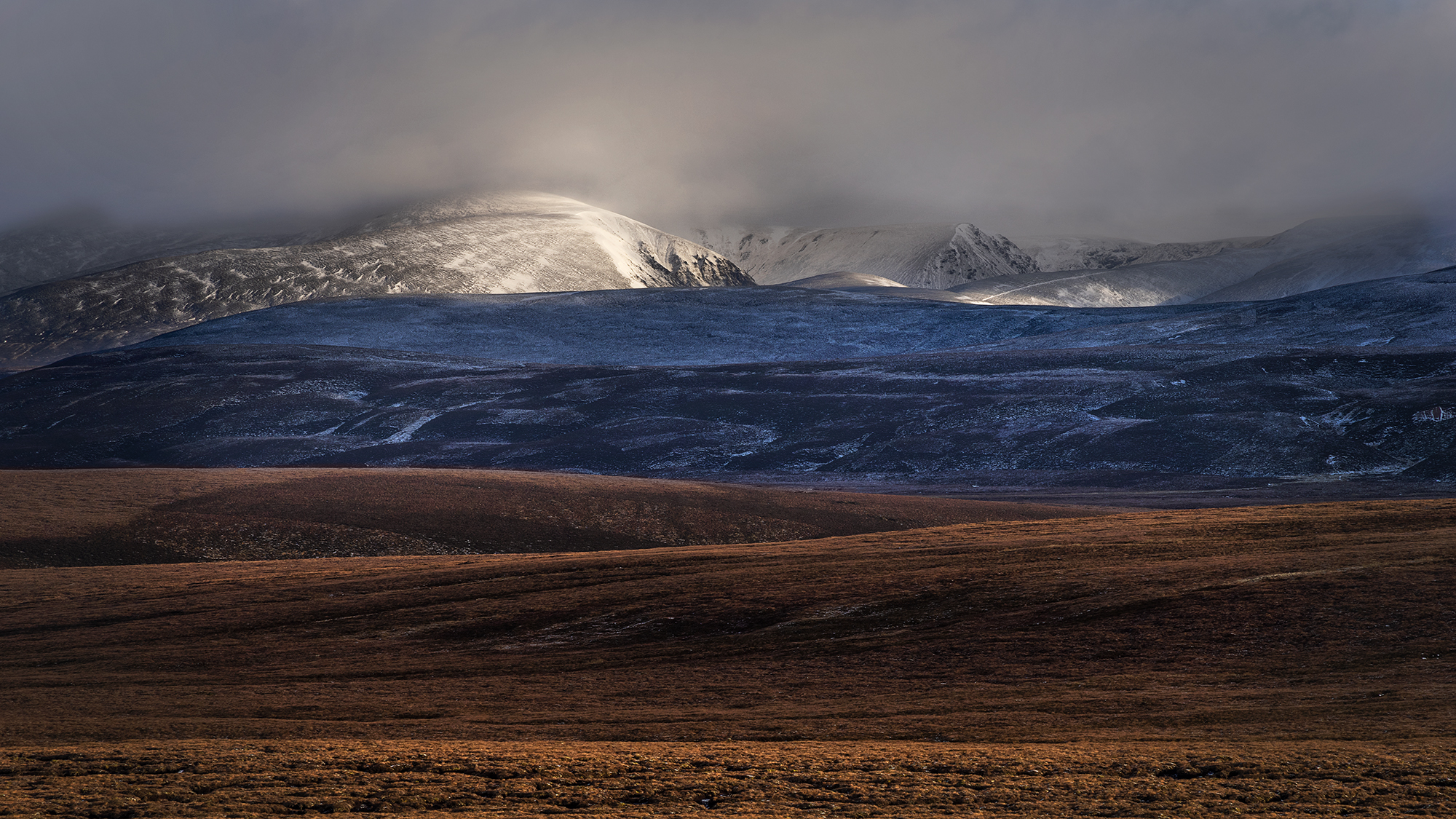
57N 3W Aberdeenshire, Mark Reeves
Taken at the intersection following the driest July for over 100 years, this image depicts a totally dry upland peat bog. The image looks towards the munro Mount Keen (939m) some 3km to the SSE. The heather and grasses were rendered white by the use of an infrared camera whilst the peat, visible in the bog gullies in the foreground and middle distance, appears black.