The practical challenges

David Unsworth
Artist, illustrator, photographer and writer. After five years at art school, David has spent the last thirty years living and working amongst mountains, first in the English Lake District and now in the Scottish Highlands. Walking has always been a major part of his practice both for subject and inspiration. Rather than the grand vista, his work explores fragments of the landscape, seeking intimate and personal responses to the vastness of the mountain environment. Photography website.
My previous article (Bidean nam Bian – A Walking Guide) described the ideas behind the first in a new series of detailed walking guides to some of Scotland's most iconic peaks. The following article charts the practical challenges of melding images, text, illustrations and maps into a concise and practical walking guidebook.
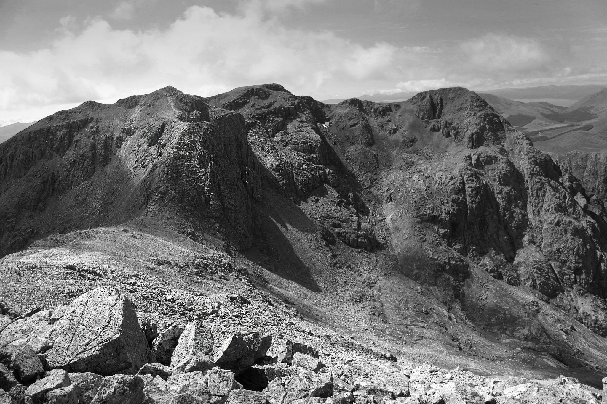
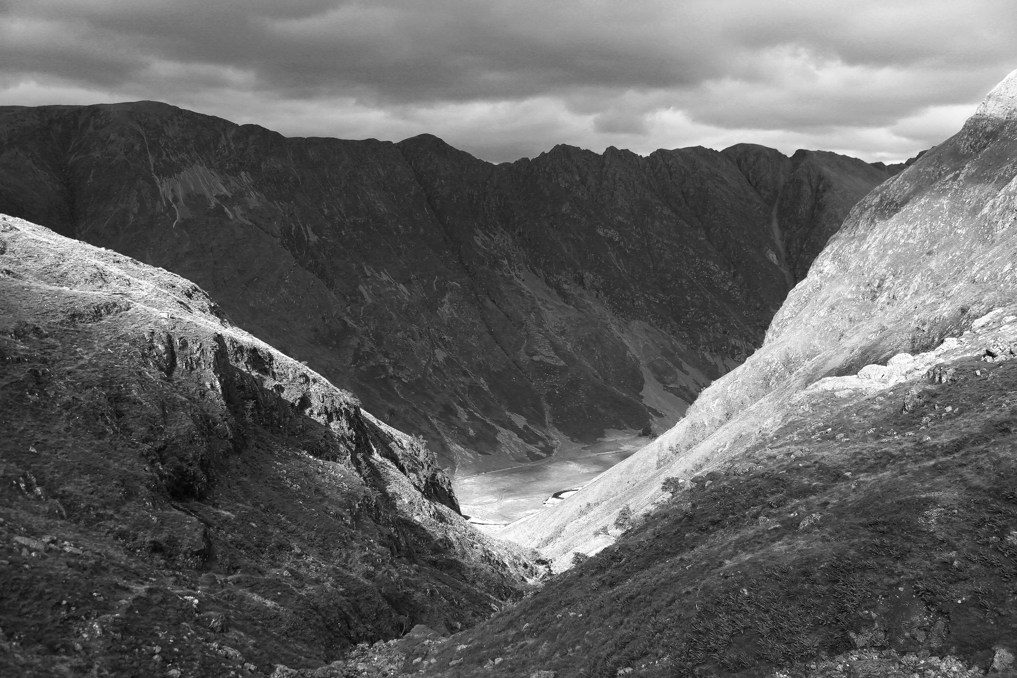
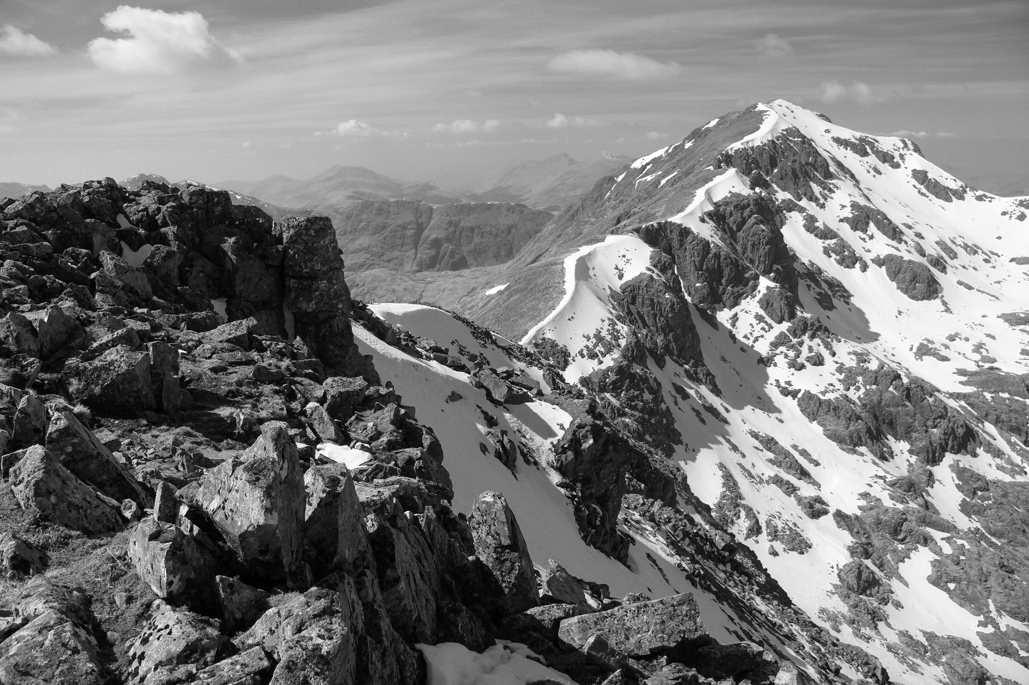
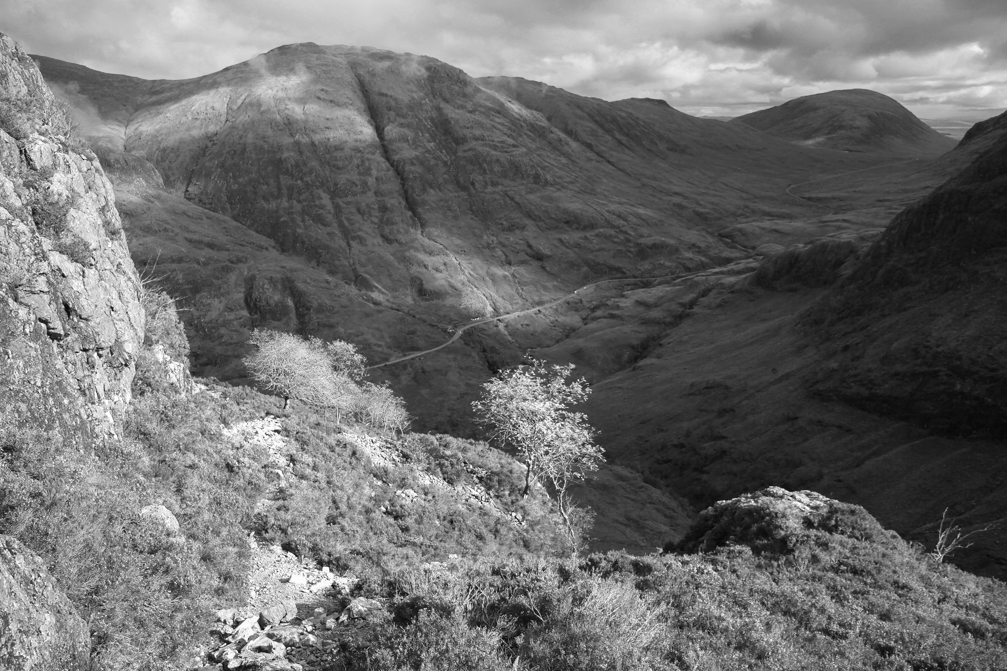
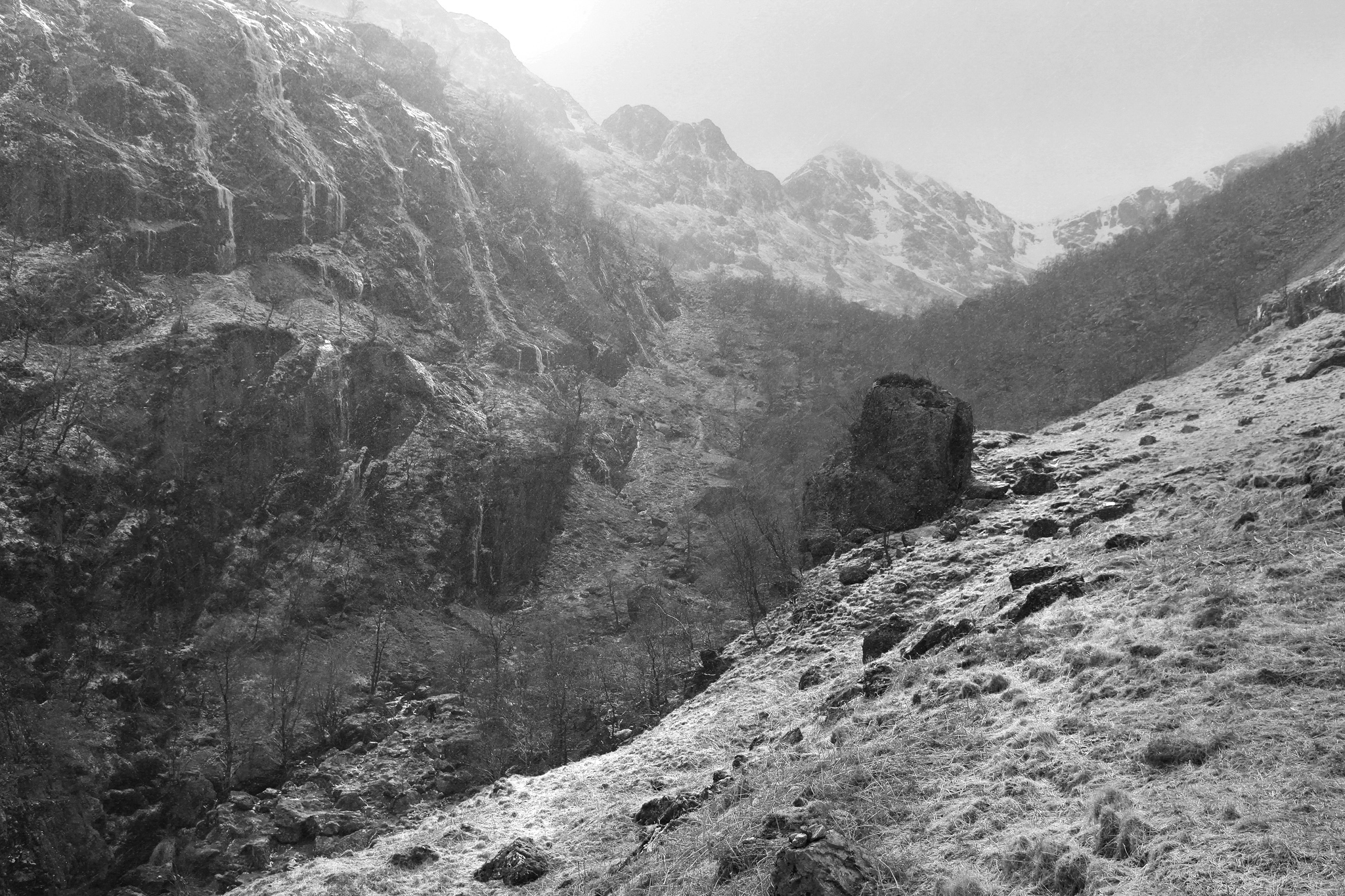
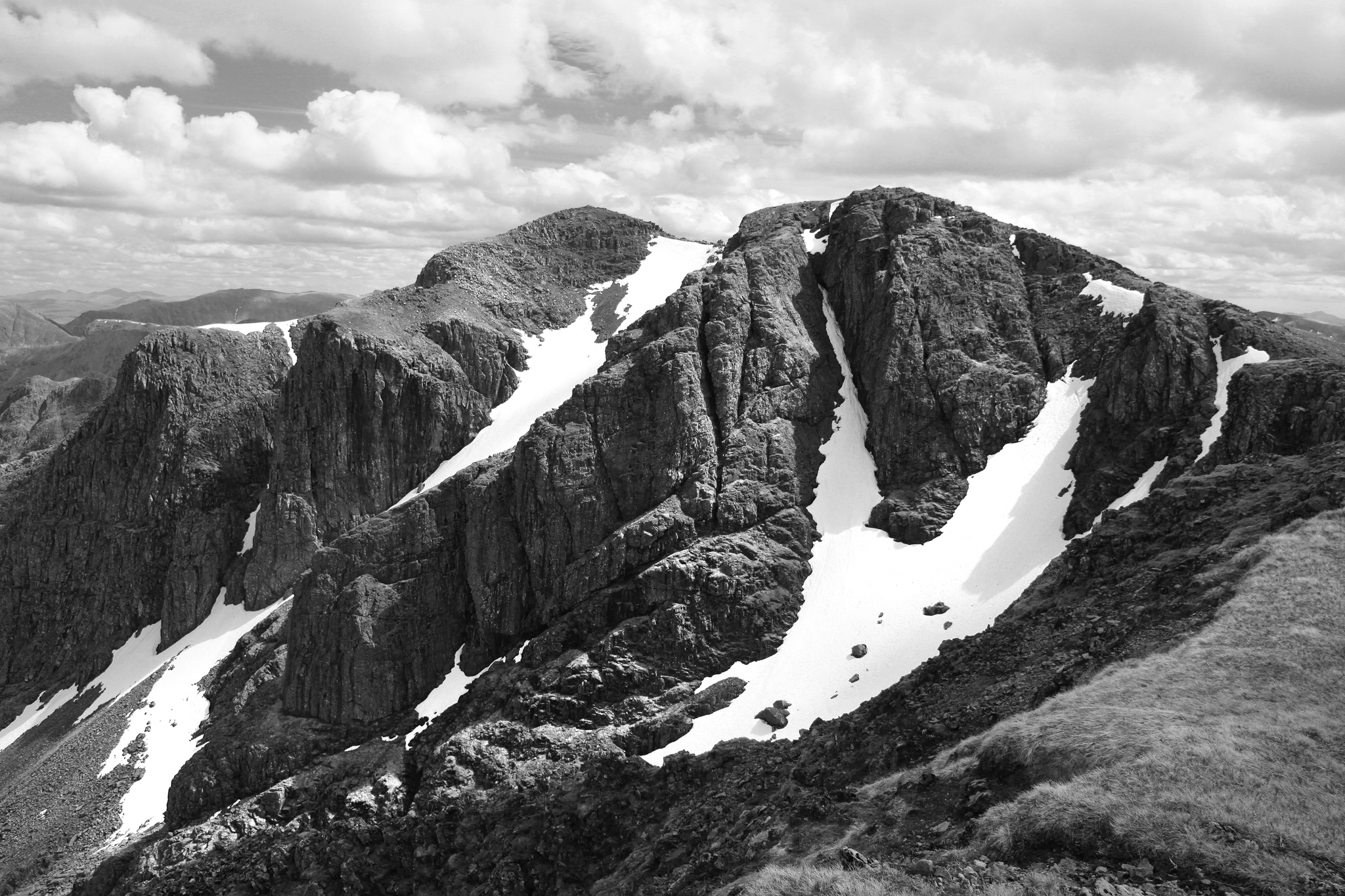
Bidean is a mountain which gives up its secrets one facet at a time. No single viewpoint, or single walk, can tell the whole story. It is a massif so crumpled and folded in on itself as to defy any attempt at a singular defining aspect. Perhaps the view of the Three Sisters from The Study comes close, although this only encompasses three of the nine hills and shows nothing of the higher peaks of the range. To journey into this mountain realm is to lose oneself in a rocky maze of ridges and corries of immense character. This is not a mountain of wide open skies and grand vistas but an almost subterranean world, enclosed and intriguing, where shattered cliffs surround haunting, silent corries, and fast flowing burns tumble through deep ravines. Once the corrie walls have been scaled, mile after mile of lofty ridges link up the summits; natural viewing belvederes high above the mountain sanctuaries of Coire Gabhail, Coire nam Beith, Coire Eilde and Coire nan Lochan.
The Routes
The concept of the book was to provide a detailed, comprehensive study of the massif, which includes the two Munros of Bidean nam Bian and Stob Coire Sgreamhach, along with all the subsidiary tops and the outer peaks.
Bidean nam Bian has a plethora of superb routes to the summit. Some are well known, but many are not, and traverse some of the most spectacular mountain terrains anywhere in the Scottish highlands. It was these lesser known routes which I wanted to highlight, in particular routes to the summits of the outer peaks such as Aonach Dubh, Beinn Fhada and Gearr Aonach (the three sisters). These mountains are right in the very heart of Glen Coe but are curiously unfrequented as most walkers generally head directly for the summit of Bidean. These outer peaks are both challenging and enjoy superb viewpoints in their own right. Any ascent can easily be extended to include the summit ridge of Bidean.
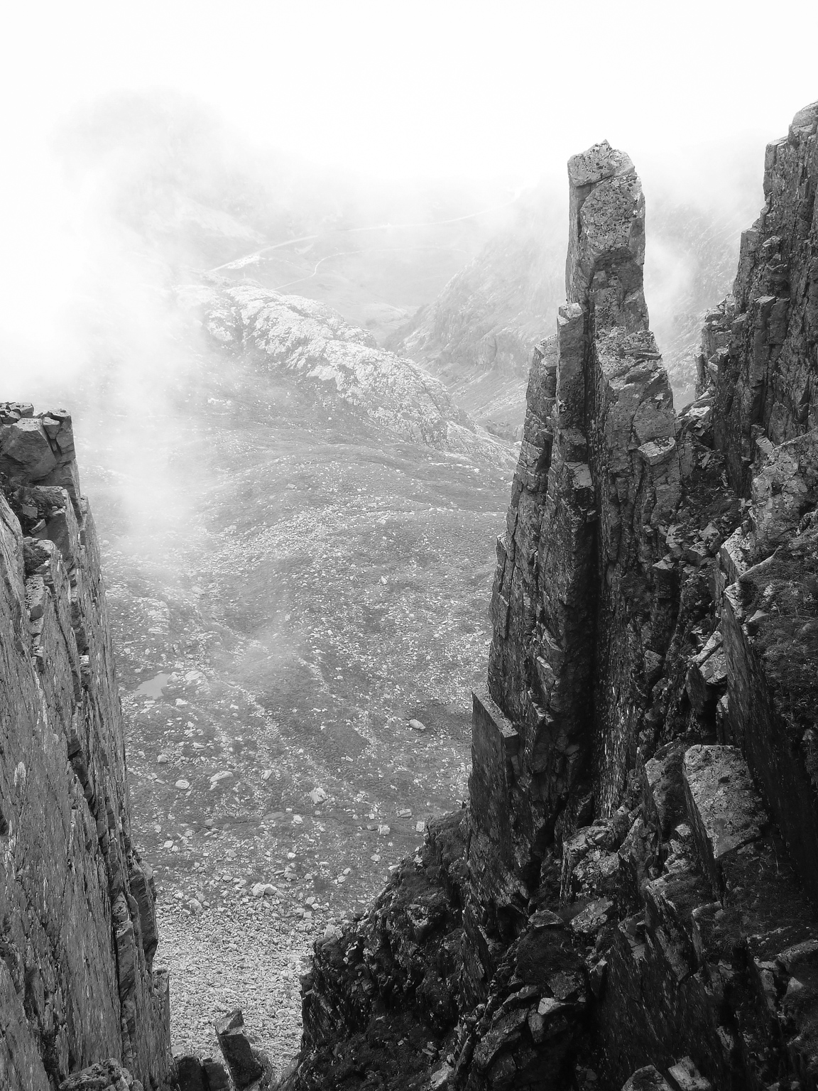
There are many fantastic routes through some wonderfully rugged ground in the heart of the massif. They explore hidden corries, tiptoe under and around some of the mighty rock buttresses of Bidean on tiny climbers tracks, and there are also routes on the quiet side of Bidean above Glen Etive where wildlife and wildflowers abound. These routes have a real flavour of gentle mountaineering about them, often weaving over steep and rugged ground by the easiest lines.
The mountain has nine separate summits, and each summit has its own chapter. As I was already very familiar with the mountain, so many of the routes were already well known, but some, and this was the fun part, were not at all. These routes were found by studying maps, scouring old guidebooks for clues and for some, just being curious and intriguing.
Taking An t-Sron as an example, the ridges were a natural place to start and one, the east ridge, turned out to be an absolute gem. There was a vague reference to it in the Irvine Butterfield guide 'The High Mountains of Britain and Ireland' but no reference of how to get onto the ridge from Coire nam Beith or any indication of the ridge above. Clearly, this needed investigating, and after an initial steep scrabble, it proved to be a fabulous route full of interest and with simply superb views. I have been up and down this ridge half a dozen times now, and it has become a firm favourite. Another route on An t-Sron, from Fionn Gleann is entirely of my own making and demonstrates my fondness for fossicking around on steep ground. It introduces the walker to the beautiful Fionn Gleann, another place which really deserves to be better known. Hidden in full view from the road through Glen Coe, this glen is an absolute gem. Full of wildflowers in the spring and early summer and with a beautiful river, this is the quiet side of Bidean.
These are just two examples, but they give a flavour of the book's less widely known routes. Finding the routes was very easy but narrowing them down was a different matter altogether.
My enthusiastic reference gathering had yielded over forty routes. The page count had reached five hundred and the book was in serious danger of needing to be split into two volumes, which would have been rather excessive for a single mountain, even one as complex as Bidean. I needed to do some pruning. The popular and well trodden routes to the summit had to stay in, in fact, any route with a path needed to stay in. I chose to discard the routes with a marked sense of exposure, this being a walking guide, so out went the Rhyolite romp and Ossian's rake due to the exposure, another steep and potentially problematic one on the north east face of Aonach Dubh, a beautiful but steep rocky scramble on the sunny side of Stob Coire nam Beith and several more. I finally settled on 31 excellent walks, which kept the page count reasonable yet still fulfilled the brief. Throughout the initial stage, I made copious notes on the ascents, particularly if it was on pathless terrain, but found that even then, I often needed to repeat a route just to make sure.The routes which were selected for the guide are a perfect mix of popular walks on good footpaths and my pick of the best pathless routes to the summits.
There are so many things I have learnt during the production of this guidebook. I had the unique privilege to work on the entire project, cover to cover, producing the text, photographs, illustrations and maps. Of course, I was working to a brief but, within those constraints, had free range to pick the routes, the aesthetics of the illustrations and maps and the accompanying photographs. The book became one of the most enjoyable projects I have worked on.
The process
One of the major challenges was linking the text description of the routes to the maps and illustrations. This was achieved by creating a standard template for each route, consisting of a brief introduction, then the route with a map, illustration and text description. Sequential numbering of each stage of the route was marked in the description and also on the map and illustration. I wanted the reader to be able to interact with the guidebook in as natural a way as possible. Some would choose the visual aspects of the guide to route find by using the map and illustration alone, some would use the text descriptions, and others would use a combination of the three depending on terrain, experience and conditions.
Looking back now, I can see how inefficient my working methods were. Many times I would go back to a route just to make sure I had the description absolutely perfect. It was often so very subtle a change which made the difference as I was learning all the time to match my interpretation of salient features on the ground to what others might see standing on the same piece of ground. Apart from these challenges, the book seemed to progress in a very organic way as routes were walked, illustrations and photographs made and maps completed, and it was always hugely enjoyable. I'm sure I could have been much more efficient if I had planned each walk meticulously before any field trips, such as matching a route walk with making an illustration, for example, but time pressures and goals achieved have no place on the hill, at least not for me. If there is to be joy in the book, then the process must be a joy. Just the sheer pleasure of walking through these beguiling mountains, spending time sketching views and watching the cloud shadows, or bathing tired feet in the crystal mountain burns at the end of a long day brought such simple happiness. Certainly, for the second book, I will try to plan ahead a little more, but we shall see.
All the routes were walked as ascents and descents at first, but it soon became apparent that some routes were steep and potentially problematic in descent. I, therefore, decided on the idea of steep up, easy down for the routes on pathless terrain, I don't want to frighten off my potential readership after all. The route planning stage proved to be supremely enjoyable, and I found so many interesting corners of the Bidean massif that I might never have found without the excuse of producing this guidebook. It proved time and again that even on a busy summer's weekend, and in an area as popular as Glen Coe, most of the hill is quiet away from the main paths. The hidden corners and secluded corries of this complex mountain massif live long in the memory.
After all the routes had been written up, illustrated and mapped, they were all meticulously tested with the help of some extremely kind volunteers. During this stage of continuous route finding and checking, I tallied up a total of almost 47,000 metres of ascent, and every day on the hill was a particular joy.
The Photographs
Although the guidebook was designed to be practical and pocket sized for use on the hill, it also needed to be inspirational, and the photographs were vital to the overall aesthetic. I had initially planned to use film as much as possible to keep with the classic 1950’s feel, but as the project went on, I found a digital workflow much more straightforward, as it cut out the time loss of having to wait for the film to be processed and scanned. The photographs also needed to be representational, to show features and topography and help clarify the written route descriptions. My interpretation of the landscape needed to take a back seat on this project which proved to be a blessing rather than a curse. Free from the burden of heavy cameras and tripods, I found a photographic simplicity which was a revelation and a relief to my ageing knees with so much steep ground to cover.
The Artwork
It was decided early on that the book should be a visual as well as an informative work. Photography is a wonderful media but can, on occasion, show a little too much information, particularly over complex ground. The illustrations were a way of showing what needs to be there but without the extraneous detail visible in a photograph.
For each route, I planned to produce an illustration to clarify the most challenging ground of each walk within the constraints of a single viewpoint. This concept of a single viewpoint was important to me as I wished to draw all the illustrations from life out on the hill. In this way, I could see exactly what was there as opposed to struggling to see details on a photograph far removed from the subject. On a purely personal level, it is what I enjoy most, sitting out on the hill with a sketchbook. Observation and interpretation are the key, but more than anything, just being alone and creatively engaged in a mountain environment that is such a pleasure.
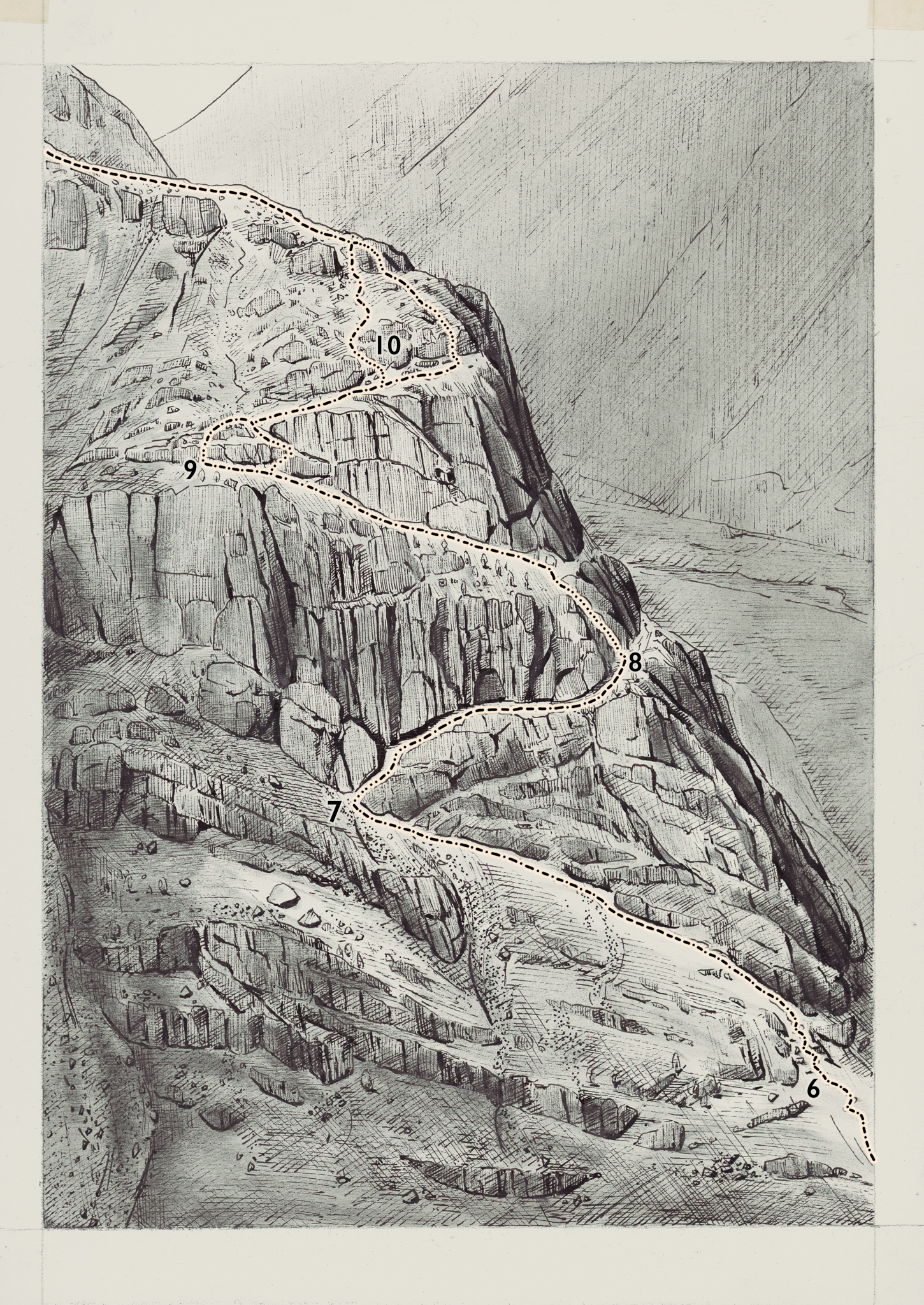
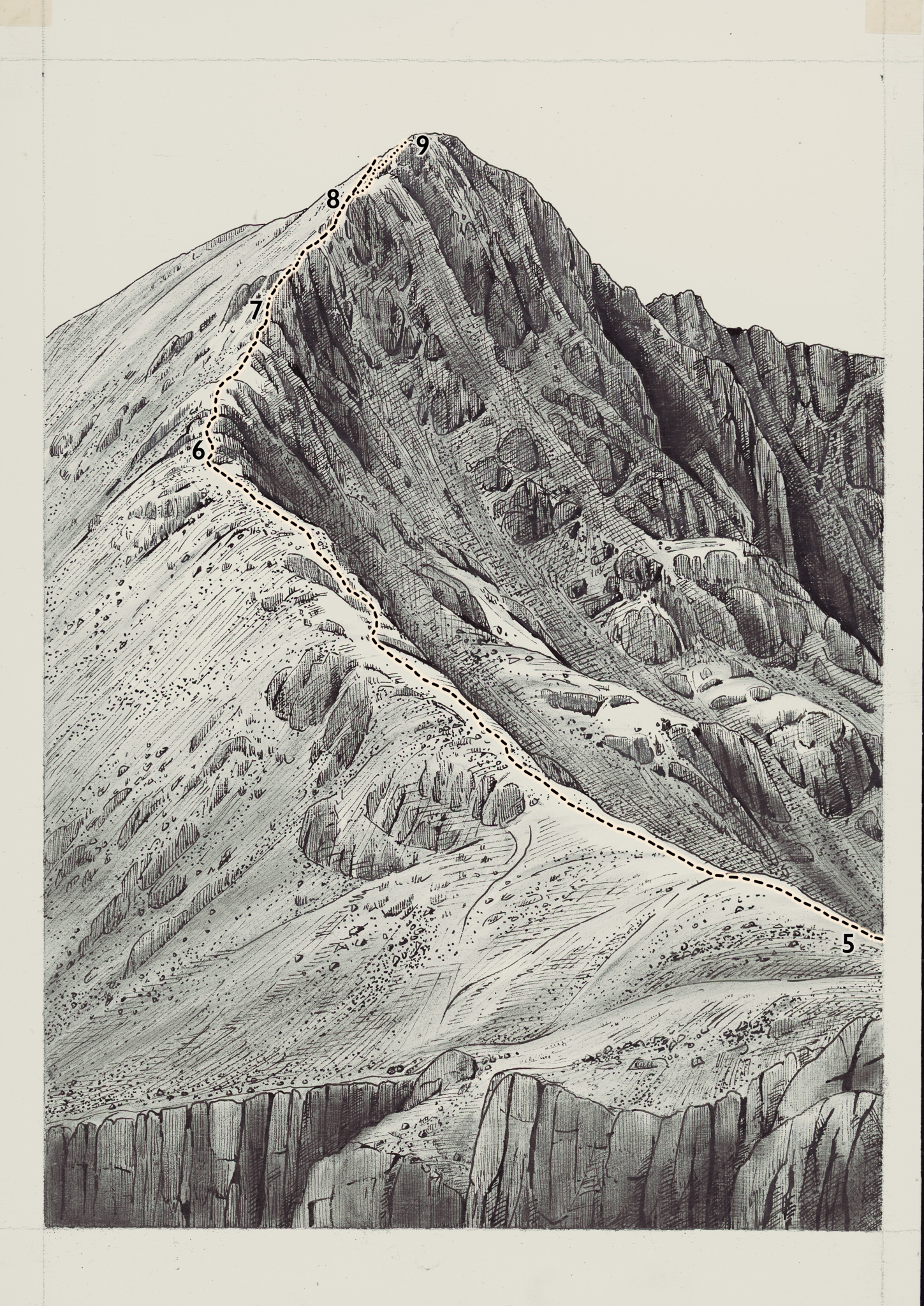
On a practical note, the illustrations needed to be extremely accurate and not subject to too much artistic interpretation. In my thirty years as an artist, my drawing style has evolved to an extent that I knowingly exaggerate form so naturally that the discipline required for these illustrations was challenging at first. I ended up using a viewing frame, squared up using a sheet of acetate to plot out key features so as not to introduce any topographical distortions.
A heavy weight cartridge paper with an acrylic ground to seal the surface was used. This ground layer has a good 'tooth' or texture which gives the ink work character as the pen has a tendency to skip over the surface. The final stage of the process is a thin, translucent layer of paint to give some tone to the illustration. I wanted the illustrations to have the appearance of a silver gelatine photographic print, and to that end, I experimented with various ideas for the paint layer. Tests with ink and wash, diluted ink in isopropyl alcohol, watercolour and acrylic paints were made but none had quite the right feel. Finally, I found a way of getting the feel of a photographic print by using powdered graphite bound in a thin glaze of zinc white oil paint. The graphite gave a beautiful silvery sheen, and the zinc white was translucent so the ink drawing could still be seen clearly underneath.
The maps are similarly hand drawn and proved to be a real labour of love. My wish was that the routes would be able to be followed by using the maps and illustrations alone, with only a brief glance at the text for clarification if necessary. All well and good, but this meant that the mapping needed to be extremely accurate. Six weeks after starting the maps I emerged from my studio looking pale and hollow eyed...but with accurate maps.
In conclusion
Bidean nam Bian, or 'the pinnacle of the mountains' when translated from Gaelic, rewards a leisurely and prolonged exploration. To walk amongst it's mountain sanctuaries, crystal rivers and challenging crags can provide a lifetime of memorable experiences. It exerts a magnetic pull on mountaineers, hillwalkers and tourists alike, a mountain of challenges and rugged beauty, and a place of secular pilgrimage for those who love the high places.
Kickstarter Campaign
Walking in Glencoe Guide - Bidean nam Bian
In order to get the book started, we looked at raising enough money to print a pilot project which we could distribute in various outlets and assess the demand for the a longer print run. This first Kickstarter campaign will support the digital printing of 500 books and, if successful, will help us decide whether to extend the print run on a full litho printing press. There are a few different rewards available but the main reward will be an early copy of what we think will become a classic series of walking books.