

Barra Hill, an iron-age hill-fort

Ian Grosz
Ian is a writer and researcher interested in Landscape and Place. He has an MLitt in Creative Writing from the University of Aberdeen and his work has featured nationally with publications including: The Press and Journal, The Island Review, Prole Magazine, Elsewhere: a Journal of Place, Southlight Magazine, Causeway Magazine, Lucent Dreaming, and in Anthology with Picaroon Poetry and Arachne Press. Ian likes to supplement his non-fiction work with photography.
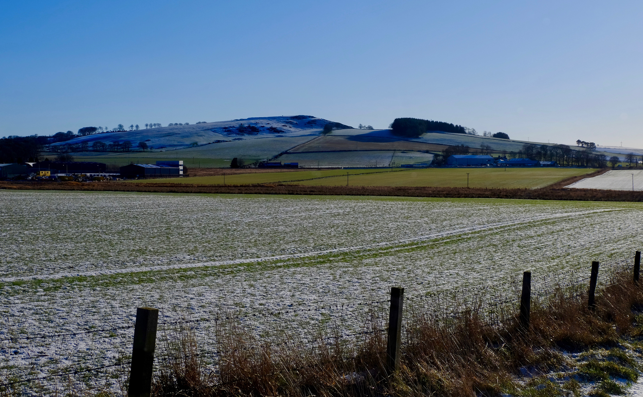
Today, a chilly autumn afternoon, I am taking one of my favourite walks. I’d like to say it is a regular walk but I take it perhaps only two or three times a year. Despite this, the focus of the walk is often in my thoughts and always in view as I draw closer to the village in which I have made my home in rural Aberdeenshire in the North East of Scotland. That focus is Barra Hill, an iron-age hill-fort that defines the landscape surrounding the village where I live, rising up a few hundred feet above the old cottages, narrow backstreets and new estates that make up the community’s housing. Even the name of the village – Oldmeldrum - is drawn from the prominent flattened dome of the hill.
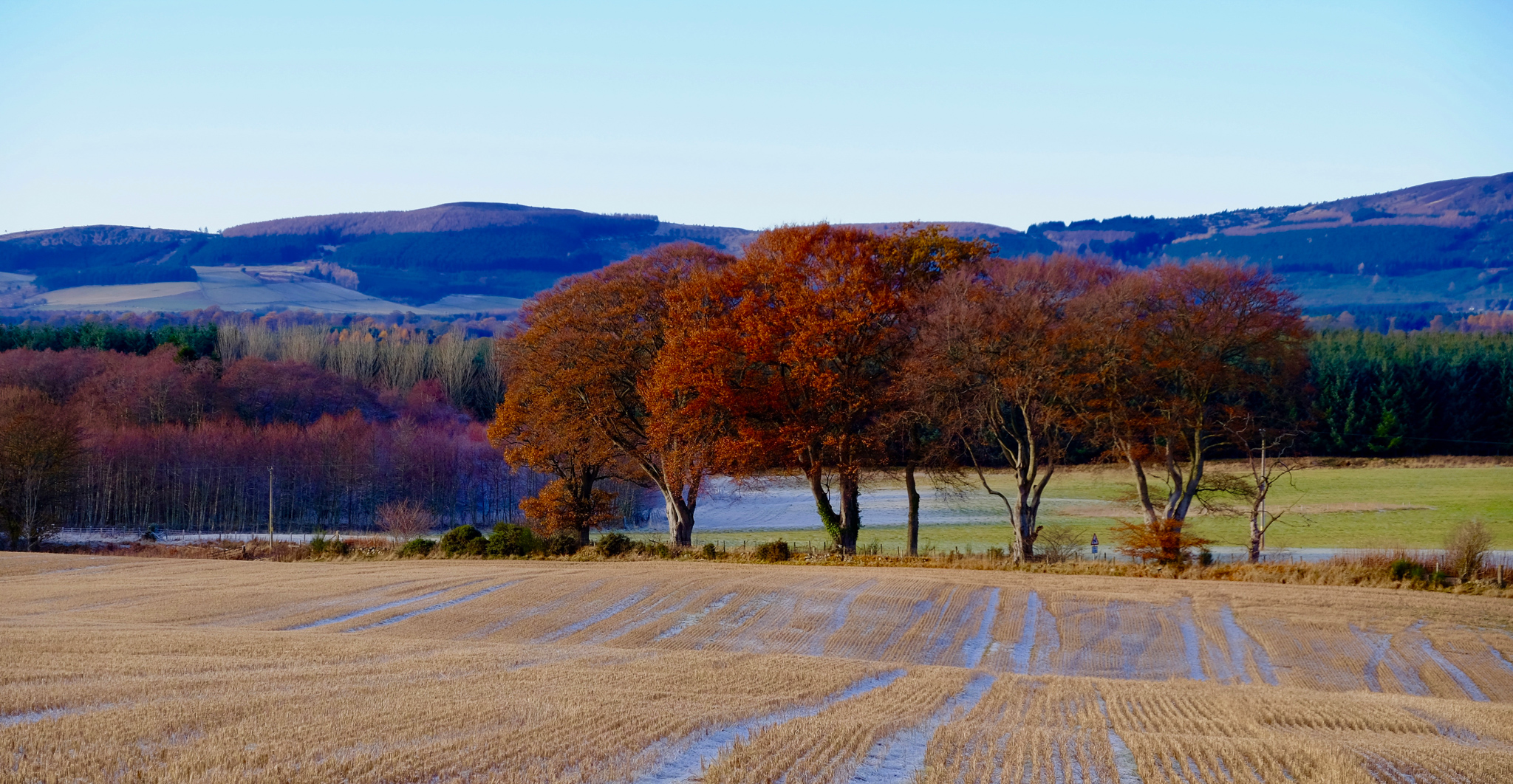
Once I leave the modern private housing estate in which I live, with the signature cul-de-sacs, driveways, neat frontages and expensive cars of suburbia, the view begins to open out and the full expanse of the hill lies before me. From here the flattened top is very obvious, and the old network of ringed ditches and walls surrounding it. On its western flank, a ring of trees sprout from a tumulus marking the burial ground of the long decomposed, prehistoric dead.
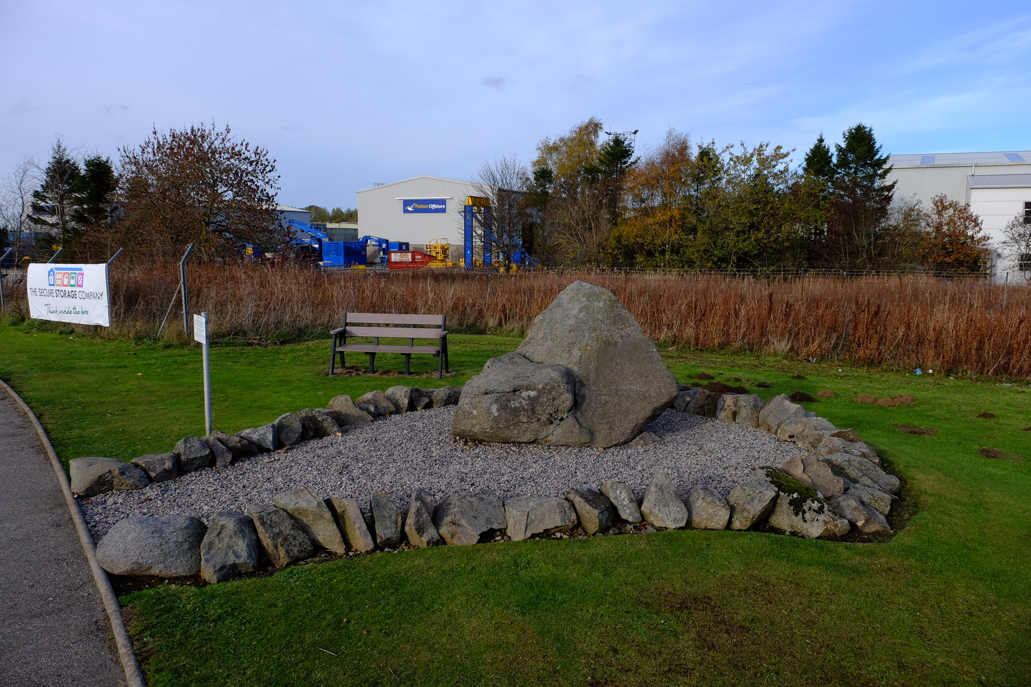
Before crossing the busy road leading to the centre of the village where I can pick up a farm track heading toward the hill, I pass a large boulder perched on a grass verge at the roundabout linking the B9170 from Inverurie and the road giving access to a small industrial estate. This is ‘Bruce’s Seat’: reputedly the very boulder Robert the Bruce sat upon to survey the progress of the Battle of Barra, and moved from its original position on the hill.
The Battle of Barra, also known as the Battle of Inverurie due to its closeness to the larger market town a few miles to the southwest, was fought on 23rd May 1308. Traditionally associated with the wider Wars of Scottish Independence, it was more accurately part of a bitter civil war fought for the Scottish Crown. It was a victory for Robert the Bruce over his enemy, the third Earl of Buchan, John Comyn, but amounted to an ignoble burning of the homes and farms of the district by Bruce’s men in the infamous Harrying of Buchan. And here lies his seat, from which he may have watched the proceedings of the battle that led to this slaughter, and to which we now attach the stories of bloody history. Here, it says. In this place, remember.
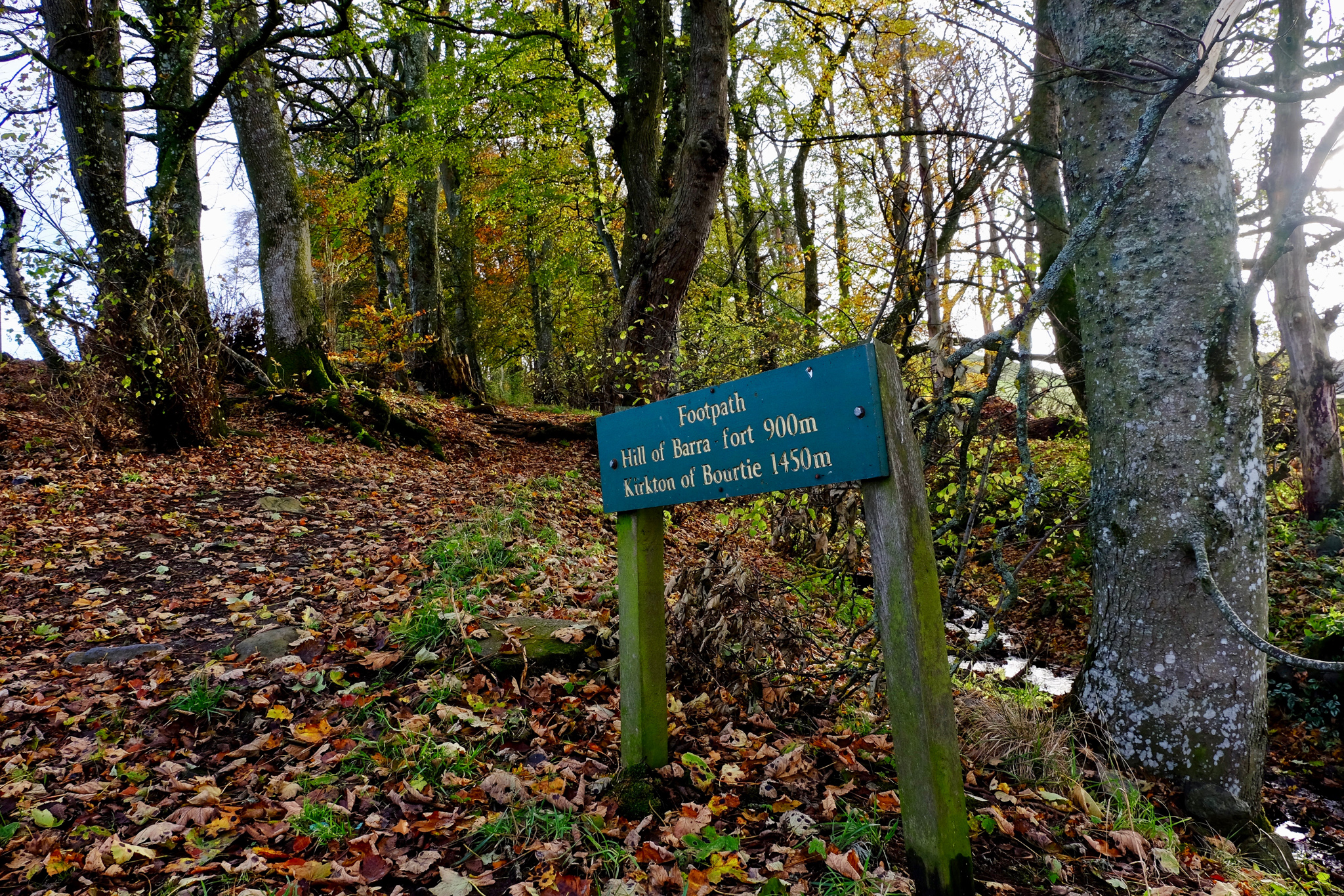
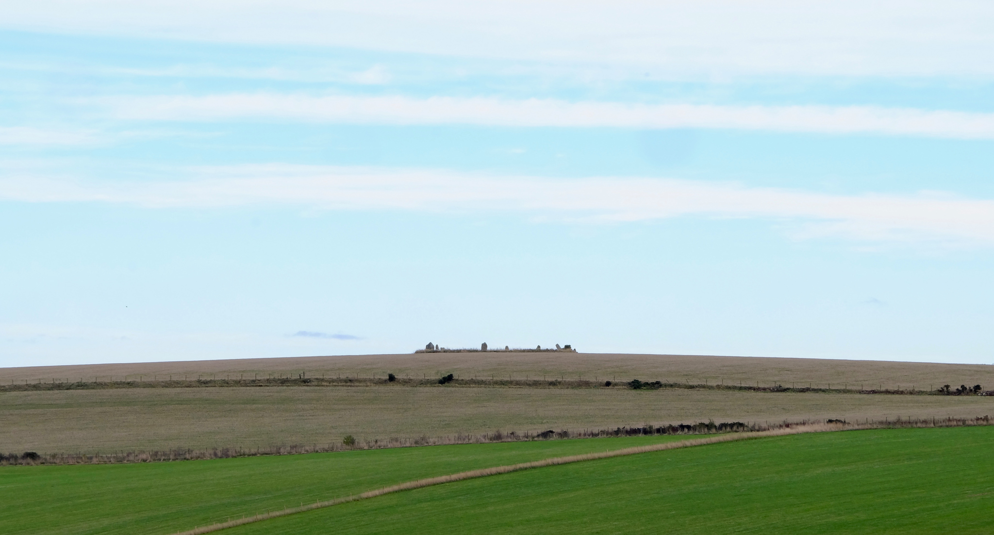
Leaving Bruce’s seat behind, I head for the farm-track which gently climbs away from the road and up toward the woods at the base of the hill. The air is cold, and my breath billows out ahead of me before being swept back and away across the fields, dispersing quickly to invisibility. Before too long I reach the end of the farm track and join a minor road heading roughly southeast to connect with another single track road leading to Bourtie, circling the woodland at the base of the hill. Another tree-ringed tumulus sits aside from the woods, and just visible, crowning the rise of a distant hill beyond a farm, are the heads of low stones arranged in a deliberate fashion.
This is Sheldon stone circle. Only six stones in the circle itself remain upright, but its total diameter of over thirty metres and its prominence on the hill suggests the location was an important place from the late Neolithic to the early Bronze Age. Originally it is thought that up to fourteen stones may have been in situ, and speculation exists about the possibility of there once being a Recumbent stone as seen in other circles close by.
Recumbent stones, that is, large monoliths placed lying on their sides within a ring of upright stones, are found only in Aberdeenshire and in Cork and Kerry in southwest Ireland. Why this unique feature should exist only in these two seemingly unconnected regions is still a mystery: whether there was a sharing of ideas between the peoples of these two areas in the Neolithic, or the parallel usage of Recumbent stones only a coincidence. The design is thought to be associated with beliefs and rituals centred on the moon since their alignments coincide with the arc of the southern moon. There are over two hundred such stones currently known in these two enigmatically linked regions, and the absence of one at Sheldon makes it relatively unique in the area. Two of the outlying Sheldon stones are known to align tantalizingly with the sunrise on the Celtic festivals of Beltane and Imbolc.
Beltane is the anglicised name for the Gaelic May Day festival, known in Irish Gaelic as Lá Bealtaine and in Scottish Gaelic as Là Bealltainn, occurring about mid way between the spring equinox and summer solstice. The May Day festival features in some of the earliest medieval Irish Literature and Mythology and marked the beginning of the pastoral season when livestock would be driven out to summer pastures. A great bonfire would be lit, the smoke and ash of which was thought to have special protective powers. The fires in the hearths of all the homes would be doused and relit with flame from the Beltane fire, and it is tempting to imagine the early people of Sheldon following similar rituals at the turn of the season, marked by the rising sun over one of these two outlying stones beyond the circle.
Imbolc marks the beginning of spring, midway between the winter solstice and the spring equinox at the beginning of February. It was a festival widely observed throughout Scotland, Ireland and the Isle of Man. Like Beltane, Imbolc is mentioned in the earliest Irish Literature and has ancient roots in the pagan worship of the fertility goddess Brigid, later Christianised by being morphed into the celebration of Saint Brigid. At Imbolc, it was said that Brigid would visit each home. Folk would make up a bed for her, leaving out food and drink. A Brídeóg, a figurine representing Brigid, would be paraded from house to house to protect homes and livestock. Feasts were laid on and holy wells visited, themselves originating in the pagan worship of natural springs.
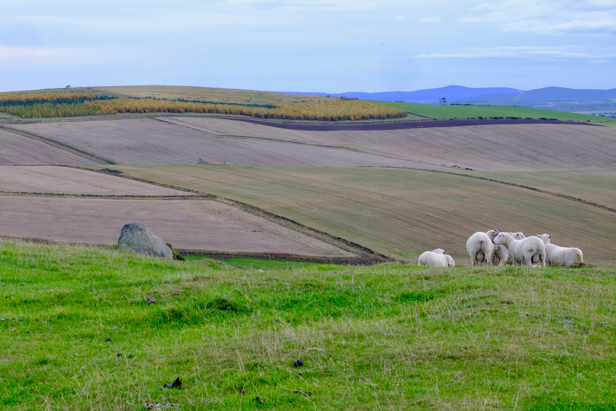
The road now steeply climbs in a southwesterly direction, skirting managed forestry land to the west and hilly open fields to the east. On reaching Bourtie, rather than turning off to head for the hill itself I continue on to the little kirk set back from the road. Bourtie is a tiny hamlet tucked away amongst trees and the folds of the fields. The humble kirk there claims over eight hundred years of Christian worship but the current building dates from 1806. Many of the stones extant in the small graveyard surrounding the church trace local families from the present day back to the 17th century. However, I have come to try to get a glimpse of a stone with older markings still. Built into the coursework of the church itself is a faded Pictish symbol stone, set high in the right hand corner of the south wall.
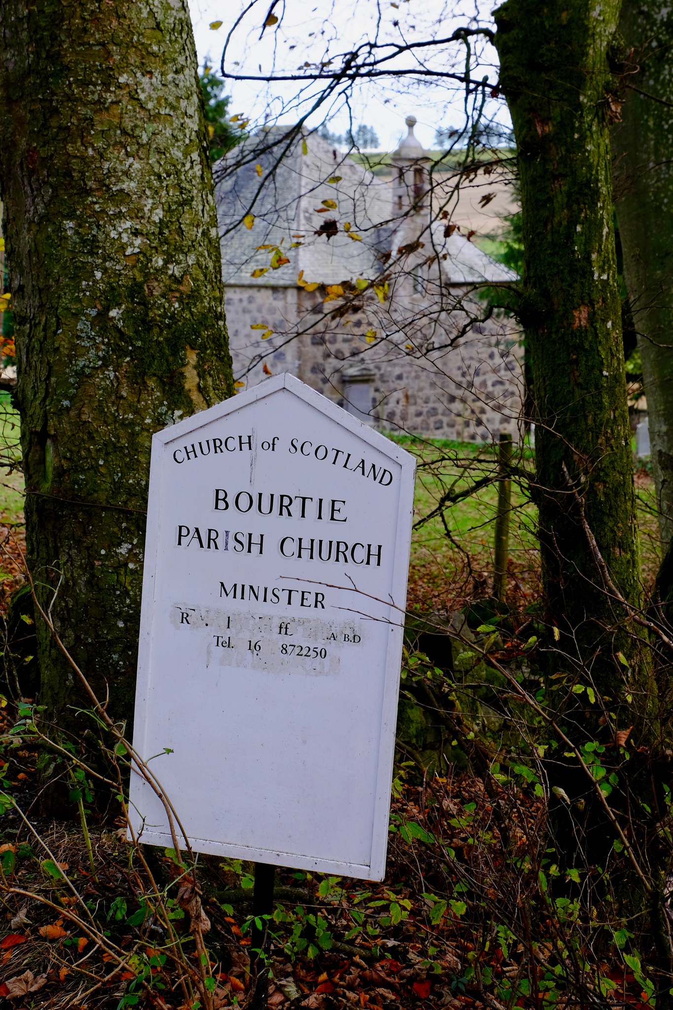
These enigmatic stones, incised and carved with symbols and other, more complex designs, are all that visibly remains of Pictish culture. The stones are found generally north of the Firth-Clyde line, east of the country to the Moray coast and into modern day Inverness-shire and Caithness. They reveal a transitional period in history between a now lost pagan culture and early Christianity, with earlier designs of unknown meaning becoming incorporated with Christian symbology in later examples.
I find the stone in the wall, but can barely make out the incised markings, which apparently consist of a crescent and ‘V-rod’ shape, along with a double disc symbol and the so-called commonly found ‘Z-rod’. There are also the remains of a comb and mirror outline. What these symbols mean is anyone’s guess, though studies carried out on common symbols by mathematicians at the University of East Anglia may suggest a form of writing which yet remains undecipherable. After squinting unsuccessfully up at the stone for some minutes, I leave the churchyard and Bourtie’s kirk to head for the hill.
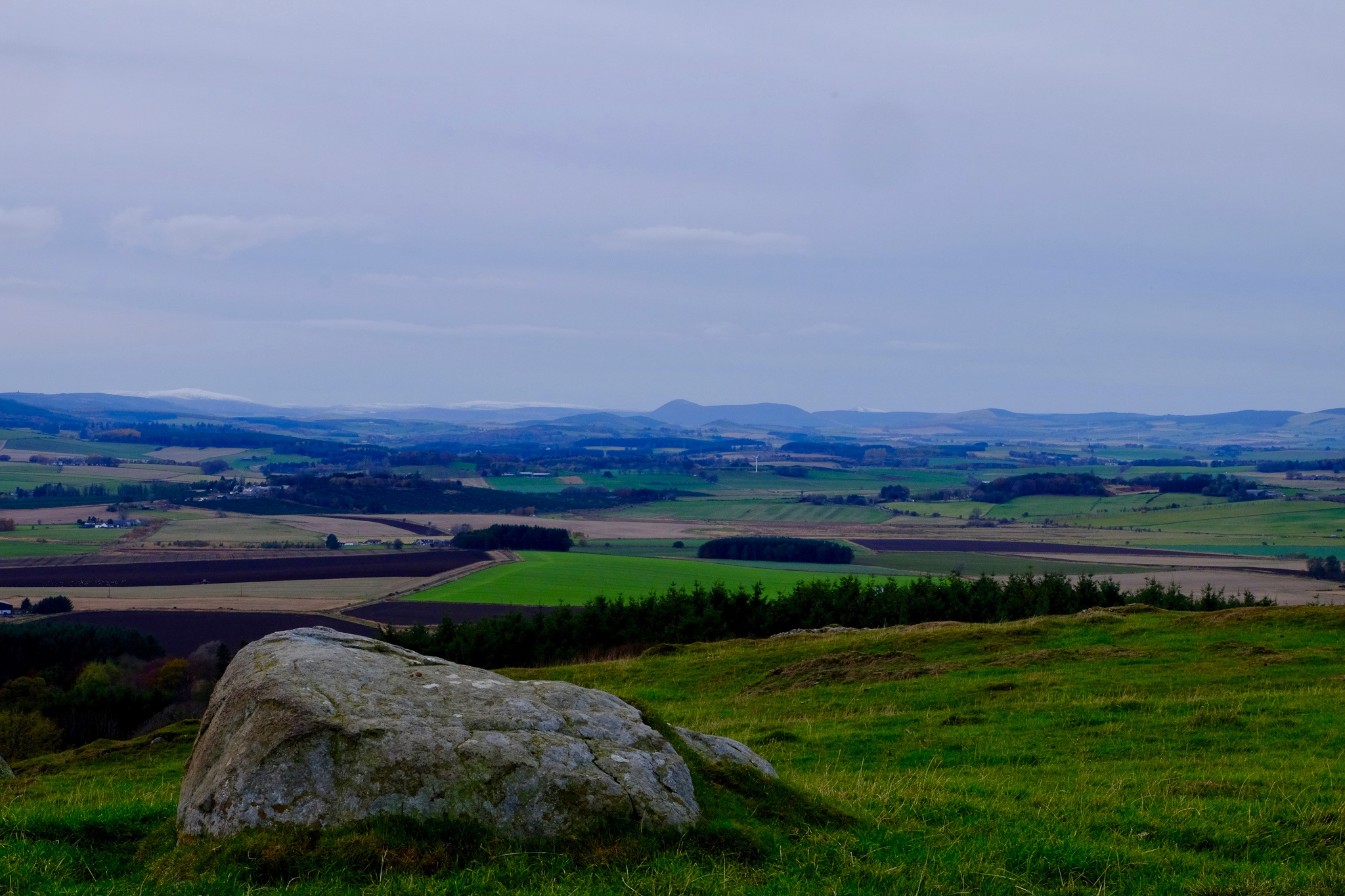
The summit is visible ahead, its dome rounding away from me toward the peaks of Bennachie and Tap o’ Noth to the west and northwest. Bennachie is the most famous hill of the area, and its most prominent peak amongst the three that make up distinct summits along the high ridge of the hill, Mither Tap, is the site of a once powerful Pictish hill-fort. The hill is steeped in mythology and lore, said to be the intersection of the country’s ley lines, and once held a colony of crofters on its lower flanks until the late 1800s. Tap o’ Noth, or ‘Hill of the North’, is another hill-fort with evidence of occupation from around 2000 BC to around 800 BC. It is a scheduled ancient monument, and with an elevation of 563 m is the second highest hill-fort in Scotland: the highest being found in total ruin at the summit of Ben Griam Beg in Sutherland. The stone foundations of more than one hundred houses have been found within its expansive vitrified walls, occurring through the after-effects of intense heat. This is a phenomenon found at many hill-fort sites; once believed to be the result of burning of the timber and stone wall structure in an attack, it is now thought that it was a technique used to strengthen the ramparts, fusing the rocks together in deliberate heating.
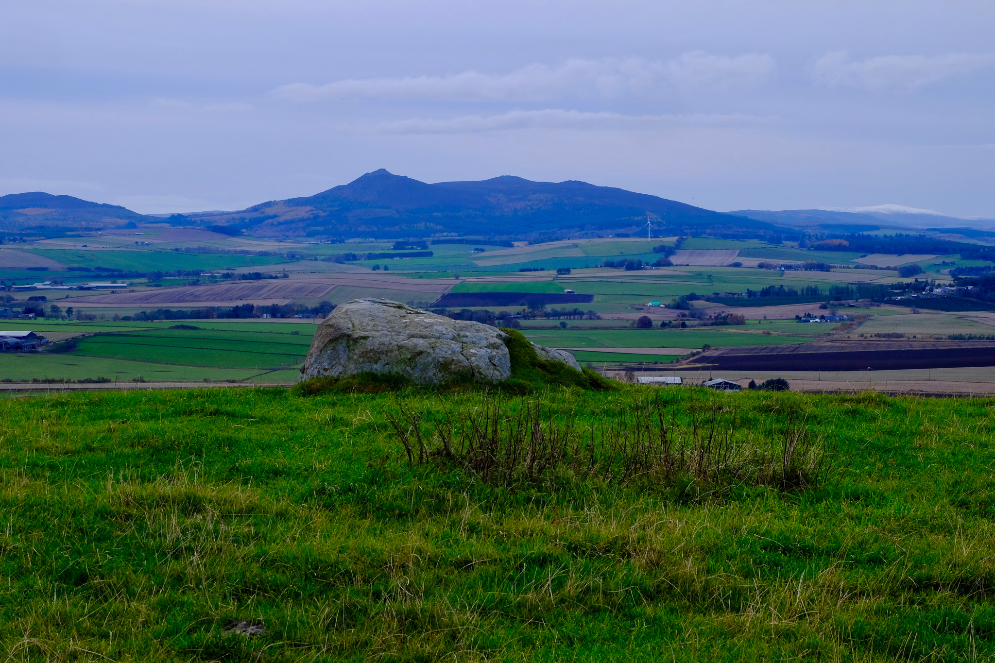
Bennachie
After passing through a short section of young woodland along the Meldrum-Bourtie community footpath, I climb the last rise across the open flank of the hill towards the summit. As I approach, the eastern entrance to the hill-fort through the earthen banks and ditches becomes visible, clearly defined in the ridges around the hill. I have an uncanny feeling of trespass as I move from the open hillside into what was once the fort, as though the ghosts of Pictish warriors still guard the ramparts, and there’s an eeriness to the emptiness of this old enclosure.
The slope of the hill falls away steeply on its western side down to the old battle site of Bruce and Comyn, now farmers’ fields, furrowed and ploughed. Oldmeldrum is also laid out at my feet: its old village centre, the new houses at its outskirts, and the small industrial estate slowly growing at its southern borders. Silent cars make their way around the new by-pass and I watch a passenger-jet traverse the sky in a wide circuit for the airport at Dyce as if in slow motion.
I think about the people that lived out their lives on the slopes of Bennachie, the Neolithic farmers at Sheldon and Bourtie gazing at the heavens, marking the seasons and their dead, the Picts, the medieval soldiers and householders who lost their lives here: the almost unimaginable thread of life stretching back, through and beyond this landscape. Then I stand, grab my rucksack and camera, and head down the hill back toward modernity and home.

-

- Bennachie