
Gibraltar ~ an incidental meeting

Katie Hayward
Katie is a photographer based in Suffolk and works full time as a freelancer in this field. Her work focuses on producing projects centred on a place where she seeks to unearth compelling narratives. She has had her work featured and exhibited throughout the UK and is a contributor for Millennium Images Agency in London. Katie holds a BA (Hons) in Photography which she studied for at the University of Suffolk.
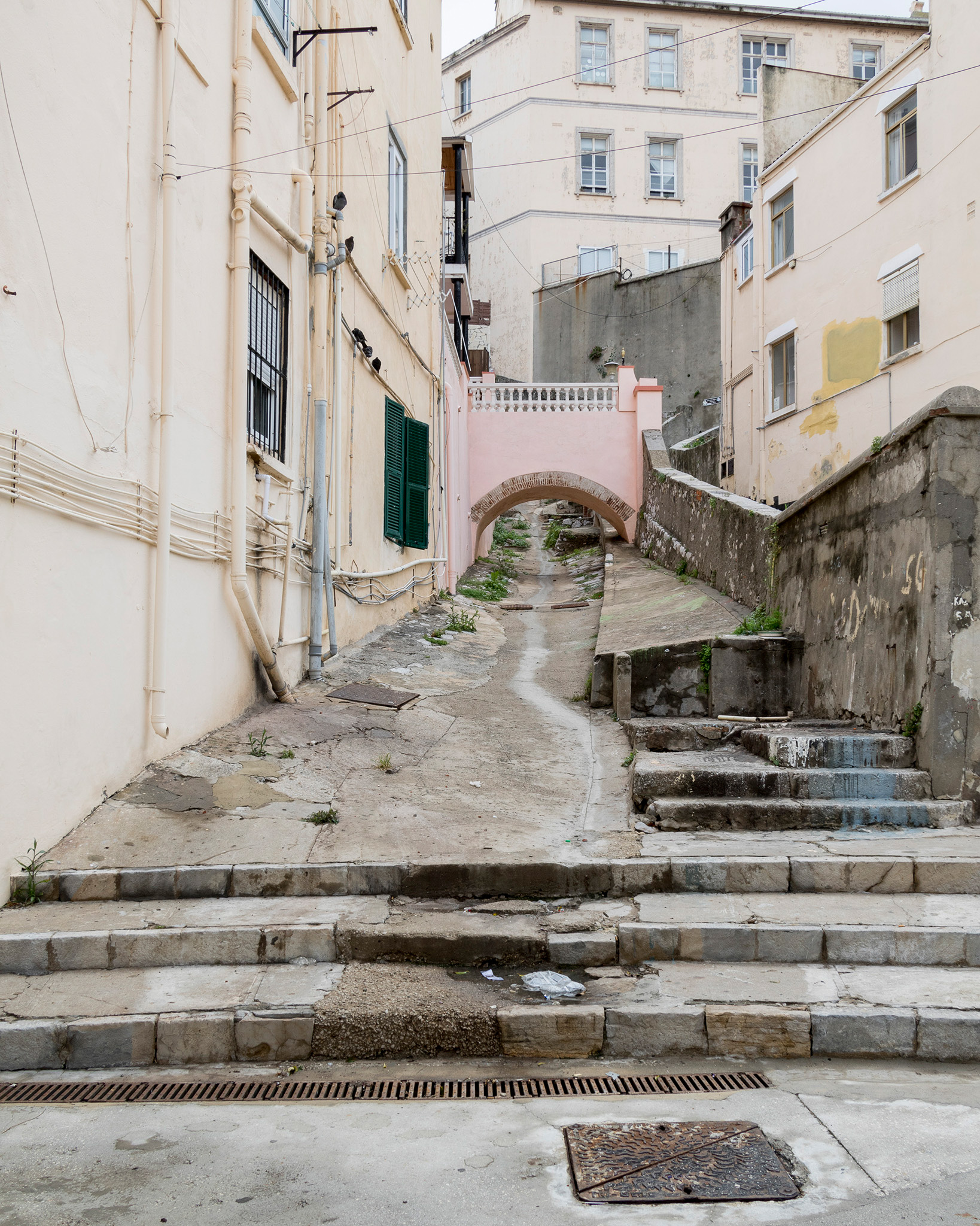
Gibraltar was a place I wasn’t overly familiar with, aside from the cultural icons we all associate with the place from the stories of others; Barbary Apes, Brits abroad, red post boxes and telephones boxes and the vernacular. I didn’t go to Gibraltar intending on producing a body of photographic work, it was an incidental meeting, but it has always been the concept of place which dominates the focus of my work.
A couple of years ago my fiancé and I went to visit a friend in neighbouring Spain, and we flew into Gibraltar as this was the closest airport. We’d heard horror stories of the landings there due to the Rock and the Strait and how this impacted upon the weather. We needn’t have worried, the landing was fine, but the Rock gave for a rather imposing and monumental greeting, its north face stands prominent next to the airport as if to assert its presence to you as soon as your feet touch the tarmac. From that point on I was captivated. We hadn’t planned on visiting Gibraltar as part of our trip, it was acting merely as a transitory place, somewhere to pass through. Looking back now, it’s hard to understand how I could have been so dismissive, but I didn’t know then what I do now.
It is quite difficult to describe the oddness of being in a foreign country, with my Euros, suntan lotion, travel insurance and Mediterranean climate to then drive twenty minutes along the coast, park our car and walk back into the UK. The familiar sights of Morrisons supermarket, Debenhams department store and the Union Jack flag anchor you right back at home, but there is something which disrupts that anchor from fully settling, such as the Gibraltarian flag alongside the Union Jack, the warm and balmy climate, the sound of locals conversating in their local dialect of Llanitos (a rather beautiful linguistic blend of cultural influences such as Spanish and Jewish) and the Spanish street names. It is an eloquent synthesis of those who have come and gone over time as a result of its military history, as well as those who move back and forth across its border with Spain every day for work and pleasure.
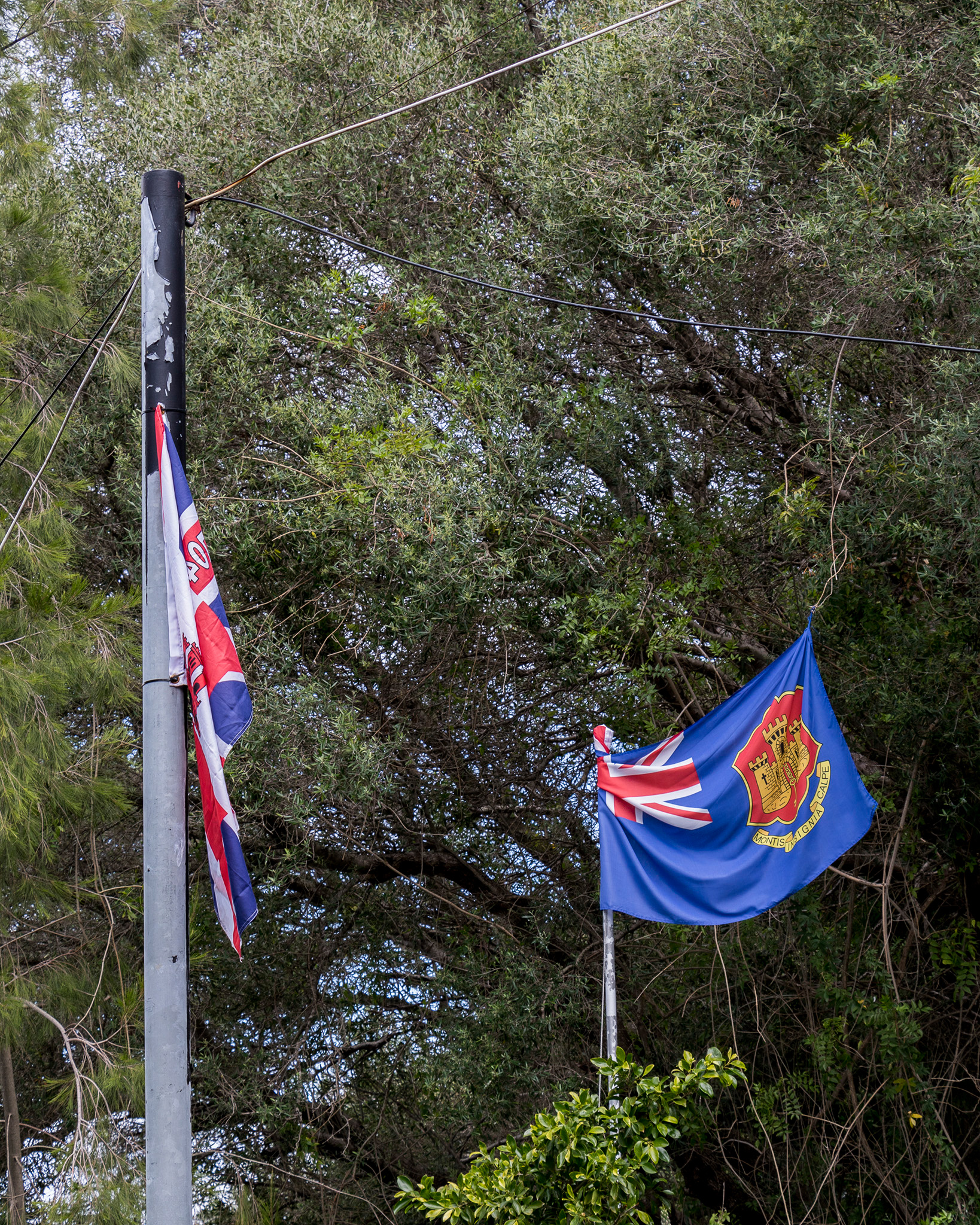
Owing to its land border with Spain, it is no surprise that families are very commonly a mix of Gibraltarian, British and Spanish. A tight-knit residential community of just under 33,000 at the last count in 2012, and an area which measures approximately 2.6 square miles it is a place where people know each other well and are in close proximity. When General Franco closed the border in 1969 in an attempt to strangle the Gibraltarian economy, the family relationships were tested and owing to the ties with neighbouring Spanish communities, families of mixed cultures were forced to choose which side of the frontier to remain on when it closed, either detached from their families and friends or from their places of work. Franco’s attempts to bring the place to its knees was not successful and his actions only solidified the bond within the community, but the scars and trauma from that period of time still remain to the point where some have refused to cross the frontier since it reopened in the early 1980’s.
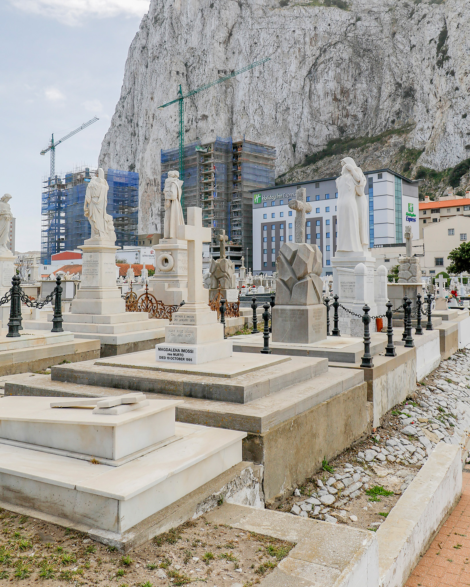
On my day trip to Gibraltar on that first visit, my initial observations were that it was very much a political landscape. Evidence of the multitude of battles and siege attempts is embedded in the land and terrain. We set about immersing ourselves in the popular tourist attractions, but I was more intrigued by everything other than these aspects. I wanted to unearth the parts of Gibraltar which we may not already know, and which offer an additional dimension to the place.
When I returned back home to mainland UK my interest didn’t fade. I spent a considerable amount of time doing research into Gibraltar whilst planning a return trip. I didn’t have a pre-conceived basis for a project, I always prefer to be in the place and to document what I see and what interests me and allow the narrative to unearth through the images. All I knew at this stage was that I was very interested in the place and wanted to be better informed before I returned to explore further.
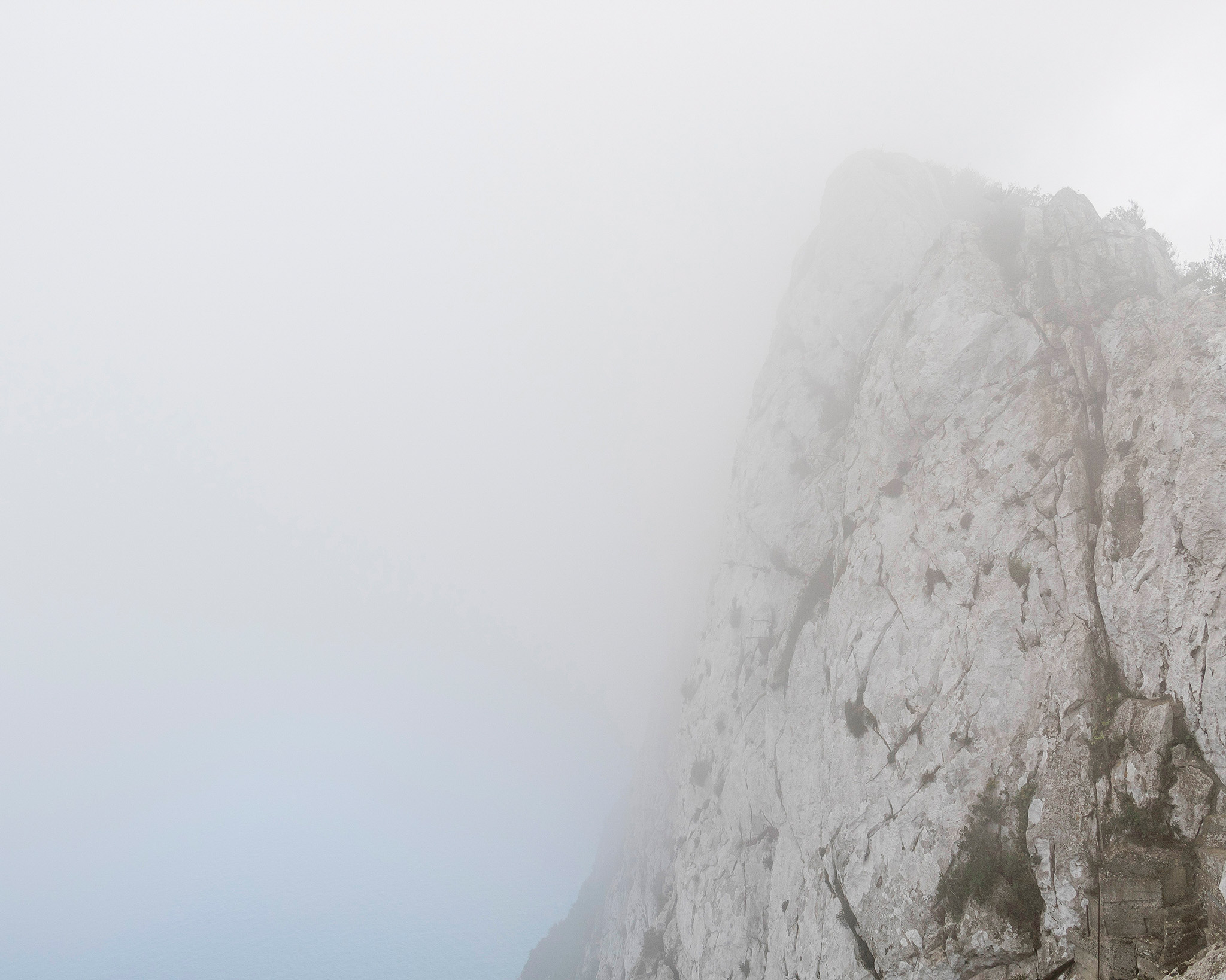
Upon my return to Gibraltar some six months later I set about exploring the peninsula and chose to do this all on foot. I find it a much better way for me to absorb my surroundings and Gibraltar is not so big that this is too much of a challenge, or at least I thought! The evening of my arrival a storm arrived which demonstrated the ferocity of the infamous Easterly wind across the Strait. I could lean into it at times and it would support my full body weight. Walking and photographing with these weather conditions was a real challenge but I was on a tight timescale with a logistical plan in place to cover as much ground as I could whilst I was there and so hiding in the hotel was not an option; instead, I considered it part of the experience and embraced it.
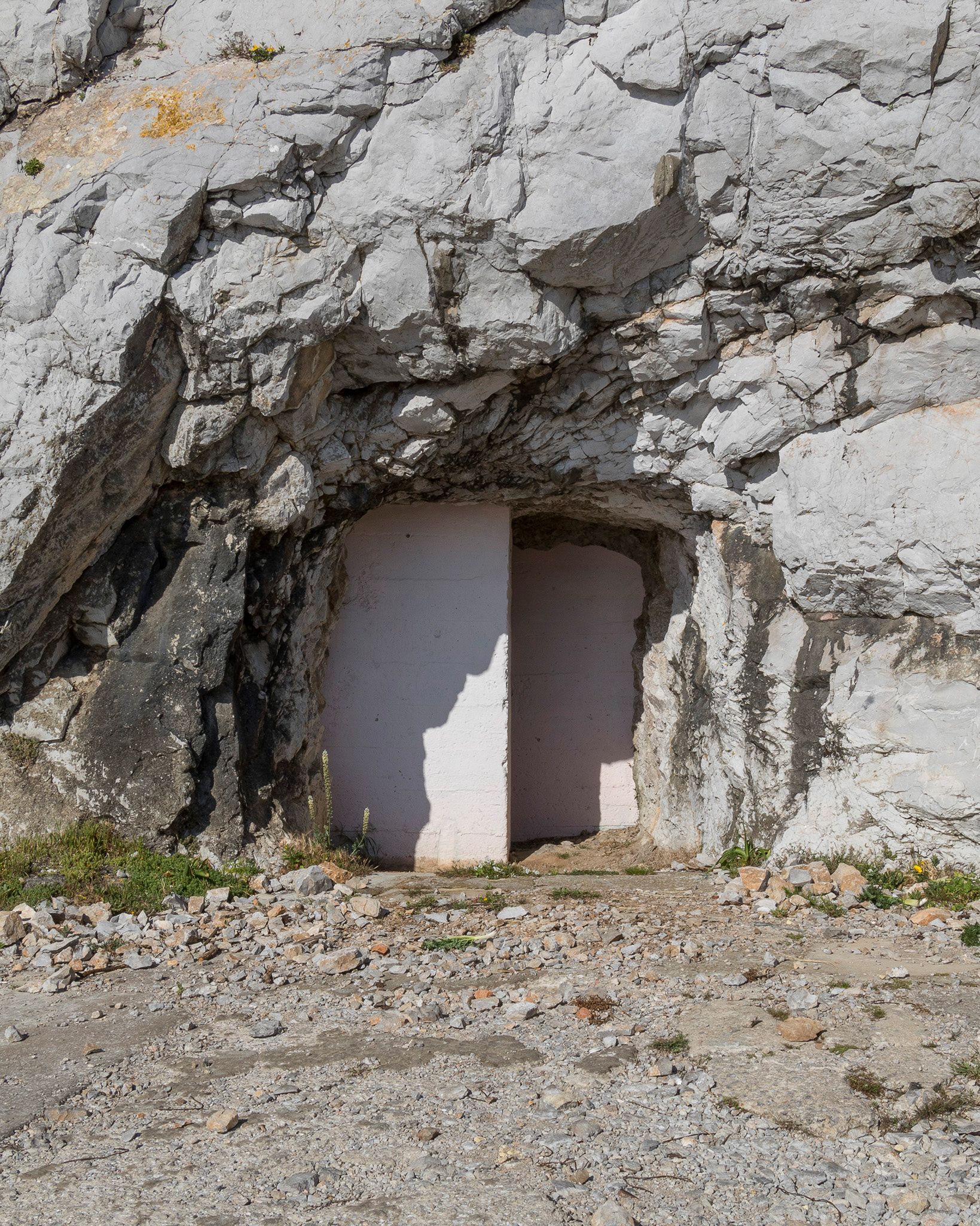
Tunnel Exit
The strong winds lasted for 3 days but eventually gave way to bright sunshine and warmer temperatures, but this posed its own challenges as well. It was in this direct and intense sun that we hiked to the summit of the rock along roads with gradients so steep I felt I would fall backwards if I stopped. Much to my amazement, locals were running and cycling up these same roads. I watched them with an immense amount of respect and disbelief. I was lucky enough to have my fiancé with me as my support and assistant for this trip and we managed to hike the full height of 1,398ft with two full camera kits on our backs. I carried a digital and 35mm kit and my fiancé carried the large format kit. It was brutal and challenging, but very much worth the effort. There is a route you can take known as the Med Steps but the locals felt this would be unsafe with our equipment on our backs and so advised us against this and we listened to them, after all, they knew this place a great deal better than we did.
When reviewing the imagery from my trips so far, I became overwhelmingly interested in the information that the landscape held within it, what it could reveal. I had captured dynamite blast scars in the walls of the rock and discovered that there is a vast network of tunnels inside the rock for defence purposes which spanned from the Great Siege of 1779 through to the Cold War era. The World War Two tunnelling activity saw the network extended from around 7 miles to 25 miles and even contained a five-storey hospital and the military occupants had to pass messages by motorbike.
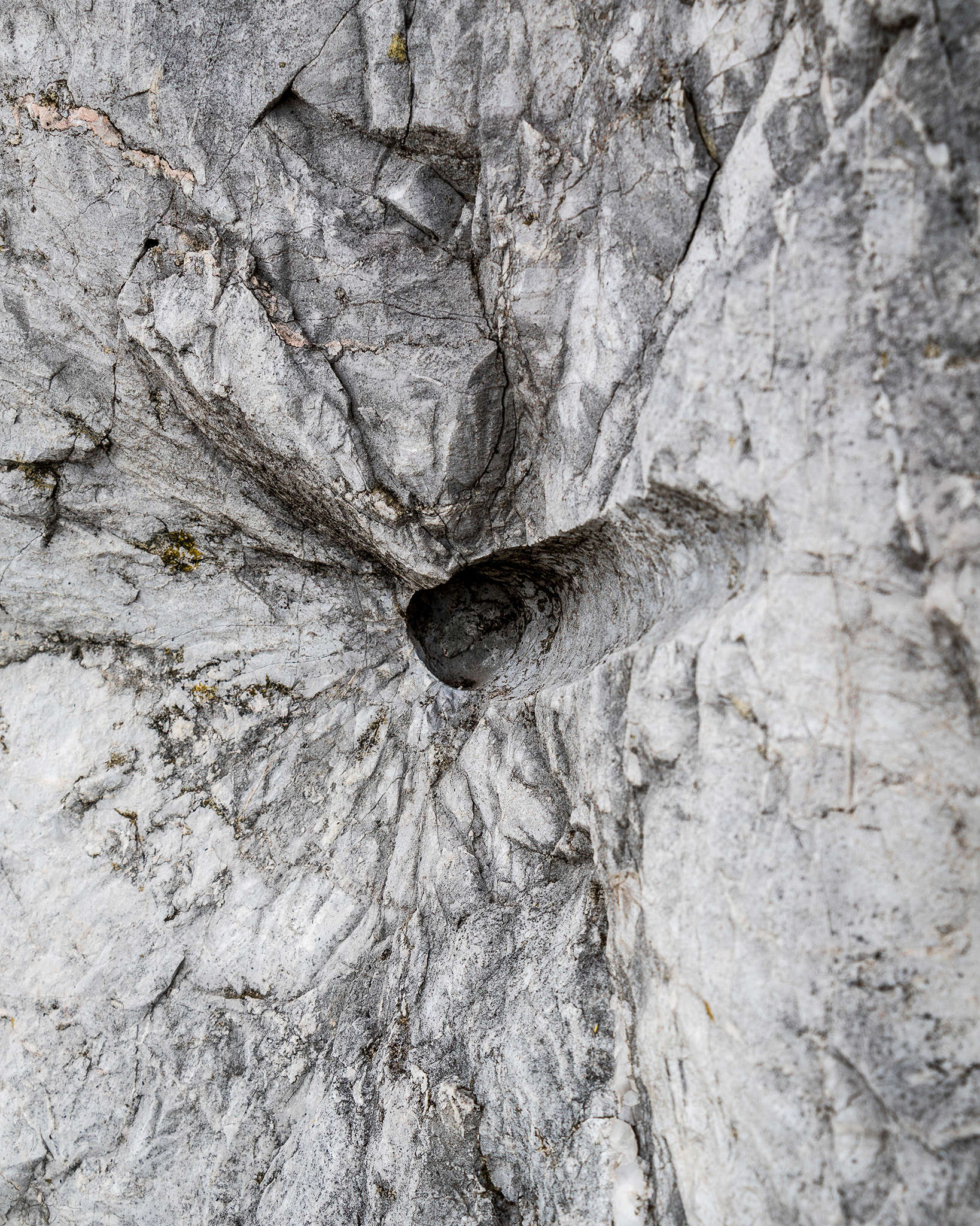
Blast Scar
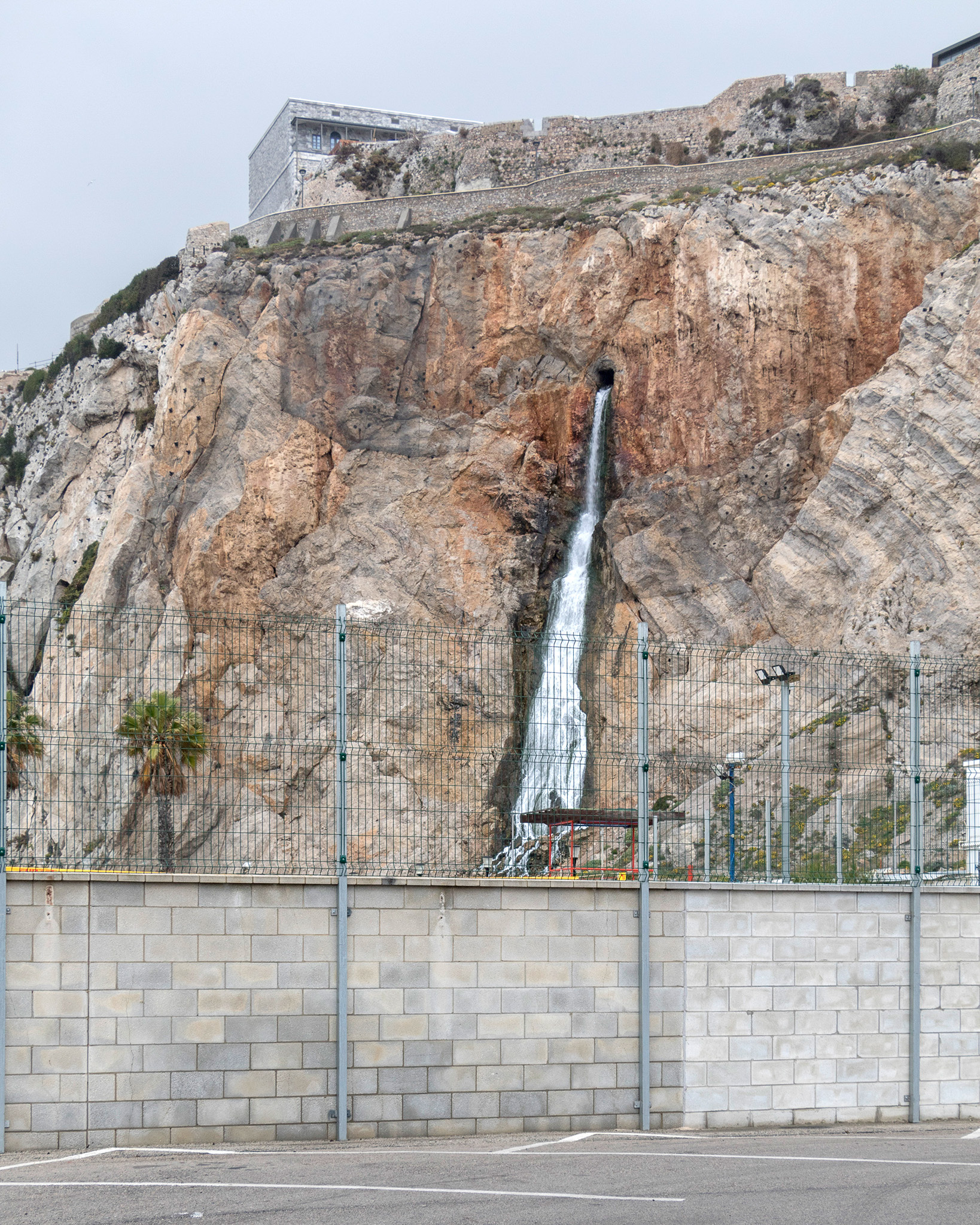
Europa Waterfall
Through the imagery, I had taken and through the research and information I was able to find, my project and the narrative really started to lean towards an interest in how the landscape had been utilised and shaped for the occupation of the peninsula and the subsequent defence of it. It was a constant jutting together of a natural force and a manmade force. The terrain also revealed to me the challenges in terms of water management and flow and how this also played into the natural forces and how our determination to occupy the peninsula meant finding ways to control this flow. There are no lakes or rivers in Gibraltar and so historically drinking water was obtained by water catchment on the slopes of the rock in addition to wells.
The Eastern side of the rock, owing to its flat surface, had at one point been covered in corrugated metal sheeting to catch rainfall as a water source but was to the demise of the plant life and wildlife which called it home. This area of the rock has now been restored and brought back to its former state, but remnants of this metal sheeting can still be seen today. Rainfall catchment soon became insufficient to support a quickly expanding population and so a desalination plant was formed, and the vast reserve tanks are contained within the rock. The waste product from this is sent back out to sea via a waterfall known as Europa Waterfall and despite being a manmade feature, appears entirely natural. The rock itself plays host to huge rooms of computer servers, taking advantage of the cooler temperatures and low fire risk and has more recently started to be used for wine storage but, it also offers spaces within it which are formed naturally such as St. Michaels Cave which provides us with a visual of how nature forms its spaces at a much slower pace and with a Cathedral-like finesse which far exceeds the brutal blasts of dynamite.
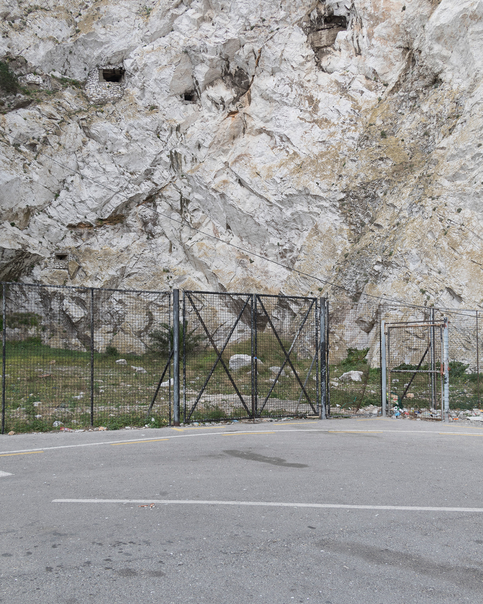
Forbes Quarry
The more significant discovery for me was surrounding the traces of the Neanderthals found in Gibraltar. At the back of an apartment, block carpark was a quarry by the name of Forbes Quarry. It was the site where a full adult Neanderthal skull was found in 1848 and was the first ever found. Traces of their lives were discovered in Gorham’s Cave where historic etchings were also uncovered. The quarry is now fenced off due to rockfall risk and is not accessible to the public. I felt profound sadness that this site was not able to be celebrated for its significance, it told us so much about ourselves, who we are and where we came from. This, for me, really underpinned the importance of what our landscapes can provide us with in terms of information, traces, remnants and scars. I hope at some point this site is given the status it deserves.
The longer-term goals for the project are that it is still ongoing, and I will continue to return to Gibraltar to conversate with its landscapes. There is still so much for it to reveal and this will always hold my interest. I have begun to exhibit some of the work this year and will be looking to expand on this in the near future.
-

- Tunnel Exit
-

- Blast Scar
-

- Europa Waterfall
-

- Forbes Quarry