What is Landscape?

Martin Shakeshaft
By profession Martin is a Photojournalist, he has worked for a wide range of publication both in the UK and abroad. He is currently a Senior Lecturer in Photography and Video at De Montfort University. He runs regular workshops for the Photographers Place and the Royal Photographic Society. He is a CAA certified commercial Drone Operator (PFCO).
Using new technology is always a dilemma for a photographer. I was interested to read about Martin Longstaff's musings on using drones for landscape photography (Issue 201). This is a debate I have had recently. With cameras being technology based, they are constantly evolving. Some tools that we now take for granted, in their day were contentious. Take the lowly flashgun for example. When it was introduced it sparked a whole debate about ethics. When asked about its use, W. Eugene Smith, the celebrated documentary photographer remarked, 'Available light is any damn light that is available!'. This sums up my approach to using technology. It is about using the right tools, to get a job done. This article looks at my experiments using drones for landscape photography.
Shortly after moving to the Peak District, I was invited to talk about my work at one of the local camera clubs. I had recently finished a project that documented the long-term effects of the 1984 Miners' Strike on mining communities, so I was talking about that. As a guest speaker, I was also asked to review some of the members work, in preparation for an inter club 'print battle' that was coming up.
The talk went well, however judging the prints, was a little more challenging. It was a strange position to be in, none of the work could be classed as straight documentary, but I did my best. Being in close proximity to the Peak District, a large proportion of the images were Landscapes. One member named Geoff, proudly showed me his picture of a sunset over the Goyt Valley. Technically it was faultless, a classic example of the 'rule of thirds' but with a little too much Photoshop, post processing, for my tastes. I asked him about the image. He explained that it was a favourite walk of his. He loved this area of the Peak.
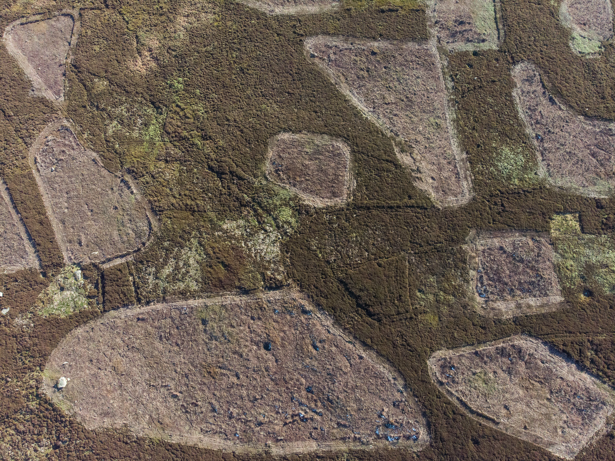
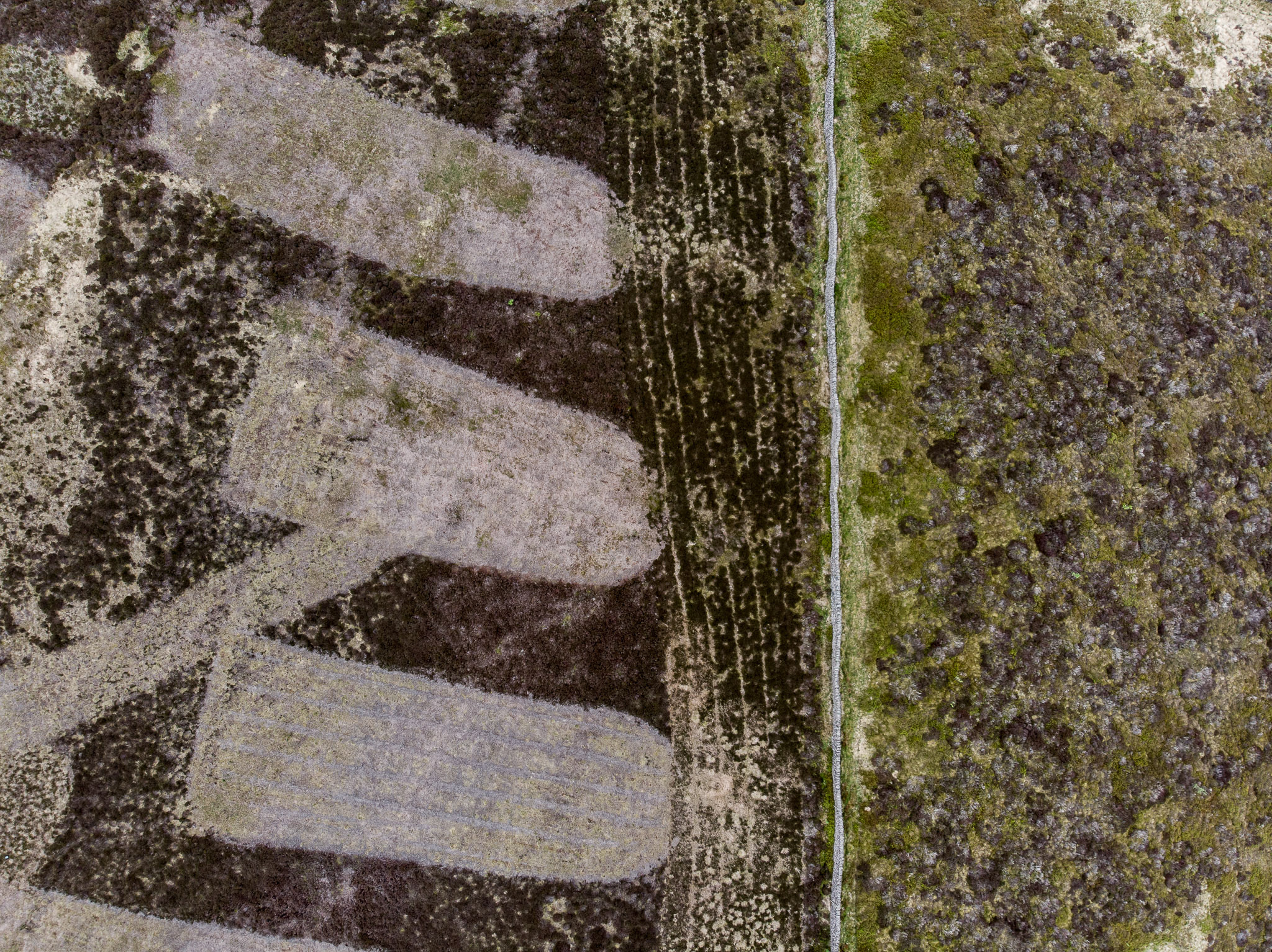
In the lower third of the image, the rolling moors stretched out into the distance. However, the whole landscape was covered in pock marks, like a strange disease. These peculiar manifestations are man-made. It is where heather is either cut or burnt back on grouse moors. The resulting regrowth becomes a key food source for red grouse and deer.
I remarked how alien it looked, but from his blank response, I could see that he didn't really understand my point. I asked him to tell me the story behind the picture. He explained that he had been walking his dog and had just got back to the car, at the same time as the sun was setting. He then detailed the equipment he had used and then went through the steps he had taken in Photoshop to make the image 'pop'. It struck me, that at no point did he actually talk about what was in the image. This was a classic case of 'looking, without seeing'.
My interest in the Peak District started 12 years ago when I moved to the area. I was lucky to meet, the respected photographer, Paul Hill early on. Paul was running an MA at a local university. His seminal book, White Peak, Dark Peak, was a major influence on my own approach to landscape work. He didn't capture pretty scenes, he documented what he saw. He collected evidence, to tell stories. We would go for day long rambles. He was a mine of information about everything. Every walk was an education.
Whilst numerous Photographic books on the Peak District books existed, few other than Paul's, tried to show anything other than pretty pictures. A much richer source of information came from local history books. One day in a local bookshop I came across 'The South-West Peak: History of the Landscape' by Eric Wood. This was a revelation. It detailed how the landscape had evolved and been shaped by man, right from the beginnings of time. It changed the whole way I 'saw' the landscape. Finely manicured hills were a sign of intensive agriculture, not just a tourist attraction. In this area grazing by sheep and deer had been the main factors in sculpting the landscape. The hills were this shape because of economics, not nature.
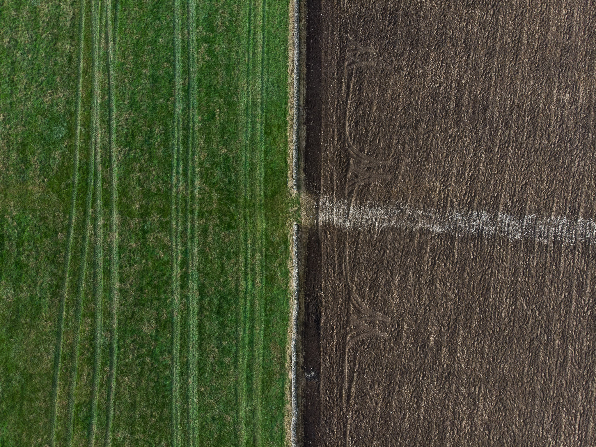
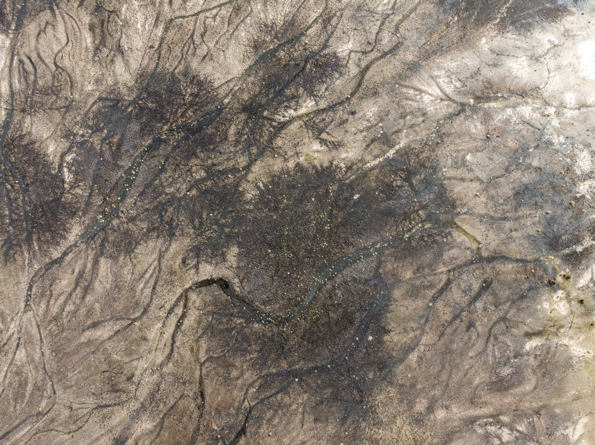
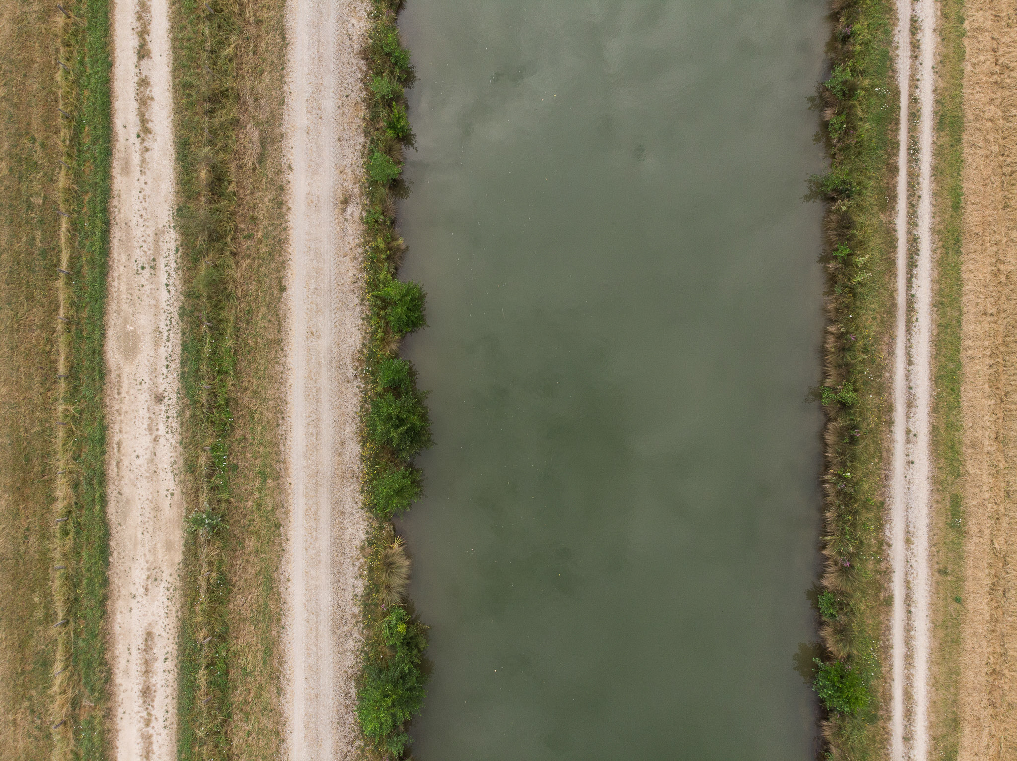
On one trip, being trapped in the car waiting for the rain to pass, I started doodling in my notebook. I was beginning to sketch out ideas for a new body of work. From a mind map, two phrases leapt from the page: 'There are no straight lines in the wilderness' and 'Just because a landscape is green, doesn't make it natural'. I realised that these two statements could form the basis of the project. I wanted to create a set of images that would engage people, but also make them think about what they were seeing.
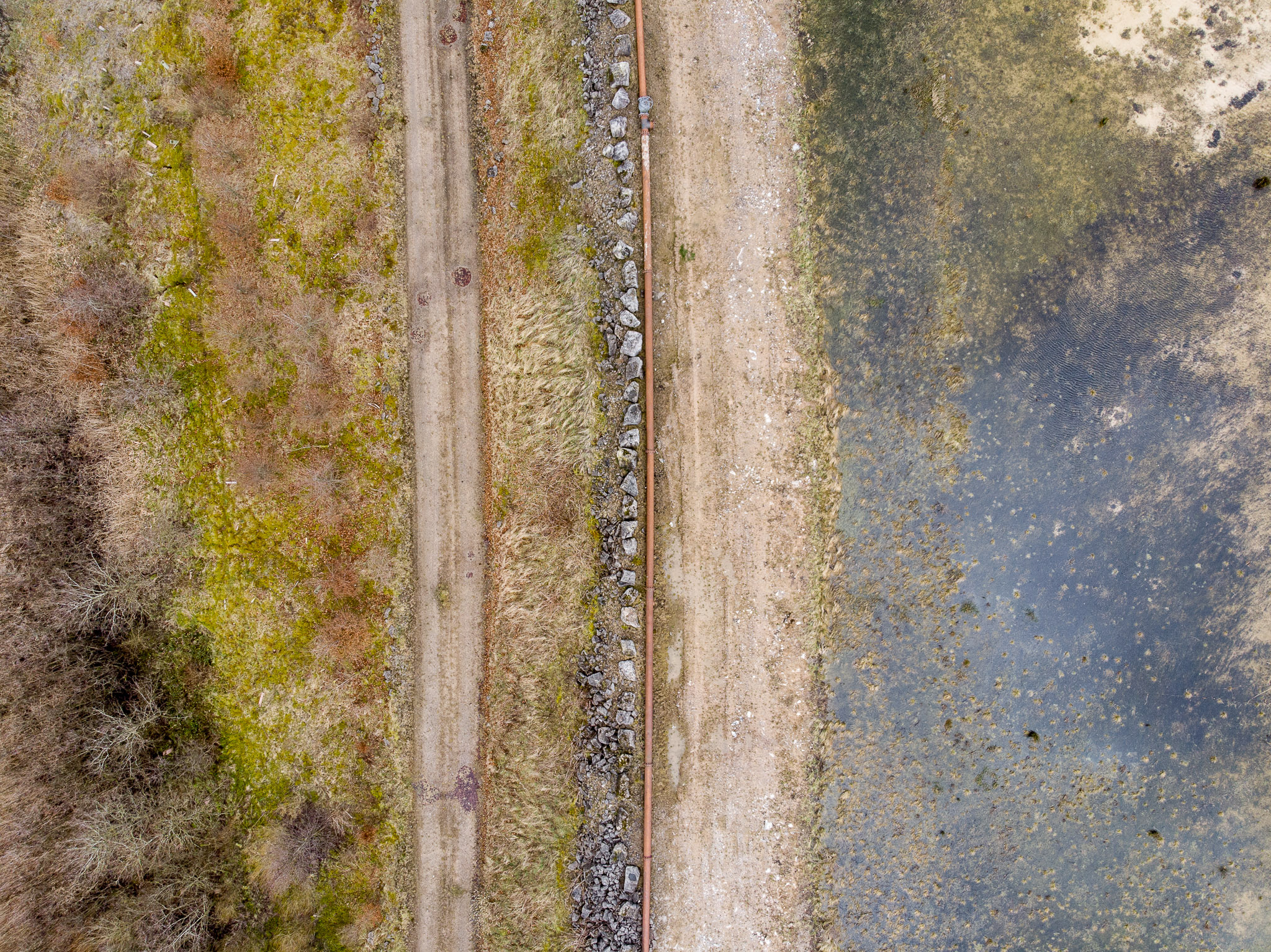
At this time, I was becoming increasingly aware of some of the ecological factors effecting the landscape. With issues such as Climate Change and Brexit, Britain as a country is having to consider/re-evaluate land management and its consequences in some detail. A growing body within the scientific community and activists have begun to explore the concept of Rewilding and managing the British Landscape, to enhance its ability to absorb CO2. In addition, as the UK is now set to leave the European Economic Union, as a country we are now reassessing how a post Common Agricultural Policy (CAP) landscape will look. This includes changing incentives from maximising agricultural production to other goals, such as conservation and increasing biodiversity. All this means that land use and its management are increasingly coming under scrutiny.
At a certain point in a photographer's career, you get the urge to get serious. All rationale goes out the window and you buy a large format, film camera. It's as though the suffering of carrying a 15 Kilo tripod and using film, will give your work some form of gravitas. Equipped with my 30-year-old mahogany and brass camera, I ventured out into the storm blasted hills. I came back with very little to show for my efforts, other than a bad back. Whilst I had begun to develop the concept behind the work, the images I was producing were not working for me. I showed them to friends and colleagues, but they did not elicit the response I wanted. I could pre-visualise some of the images I wanted to take, but the equipment I was using, wasn't getting me there.
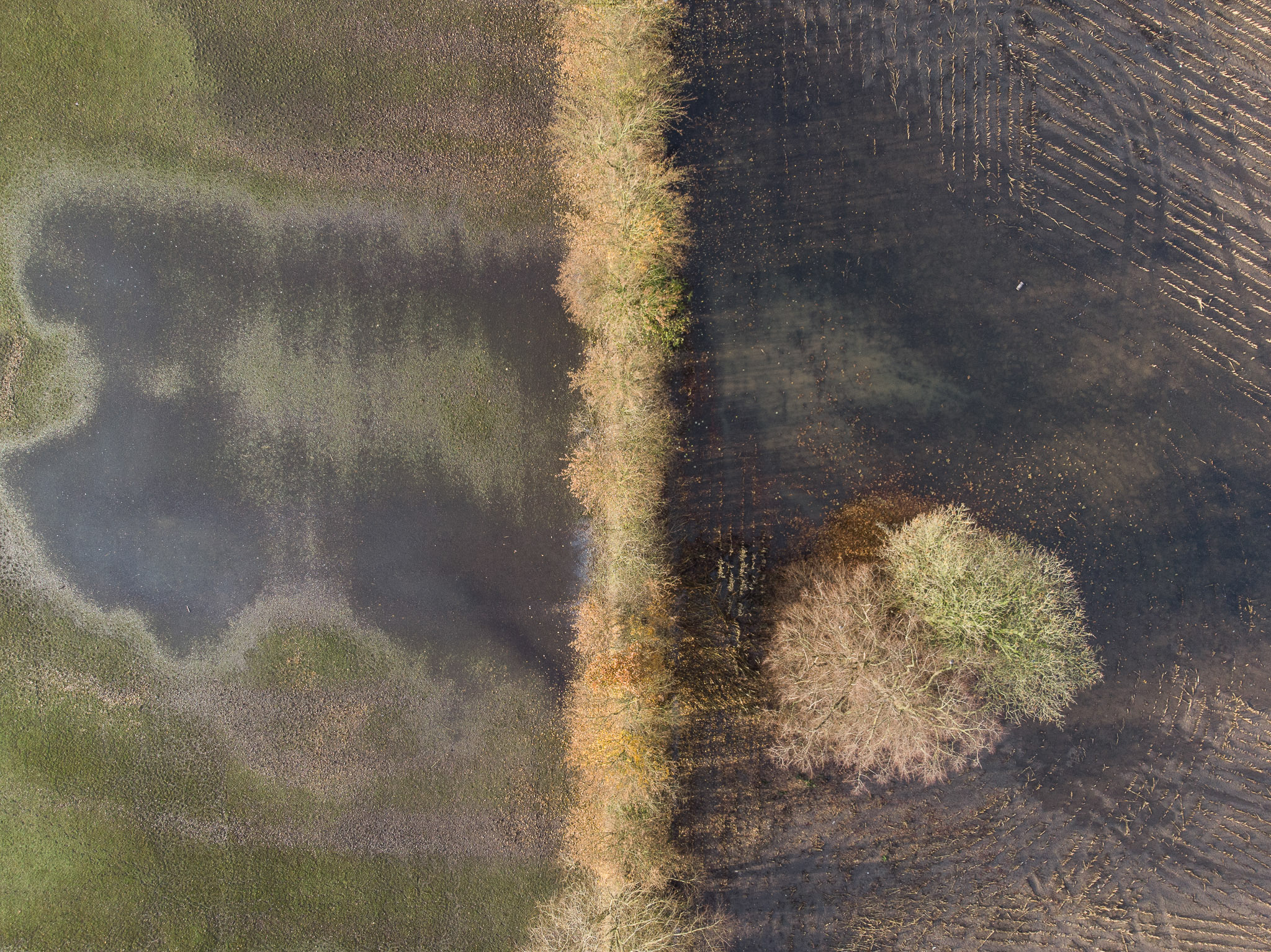
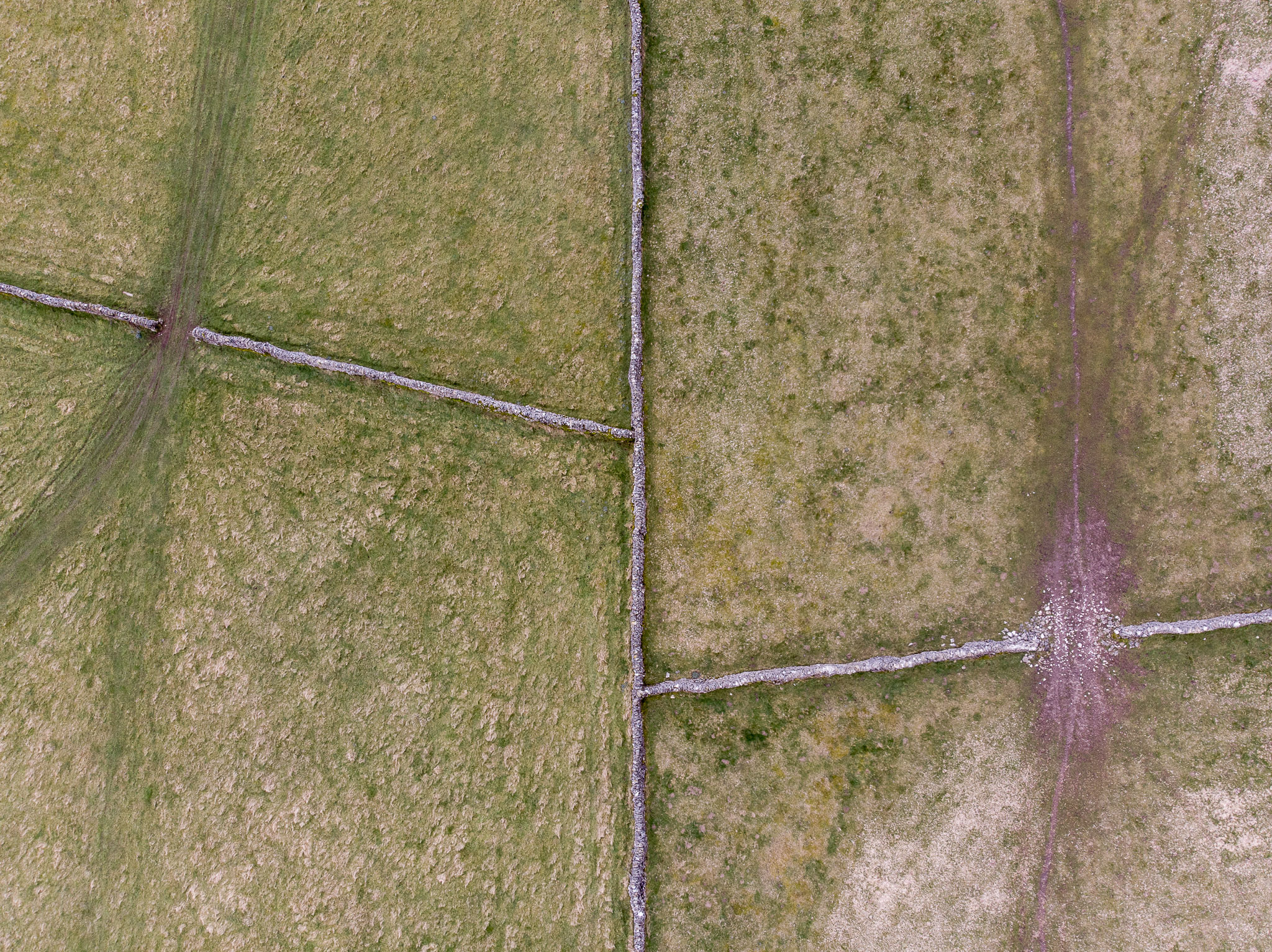
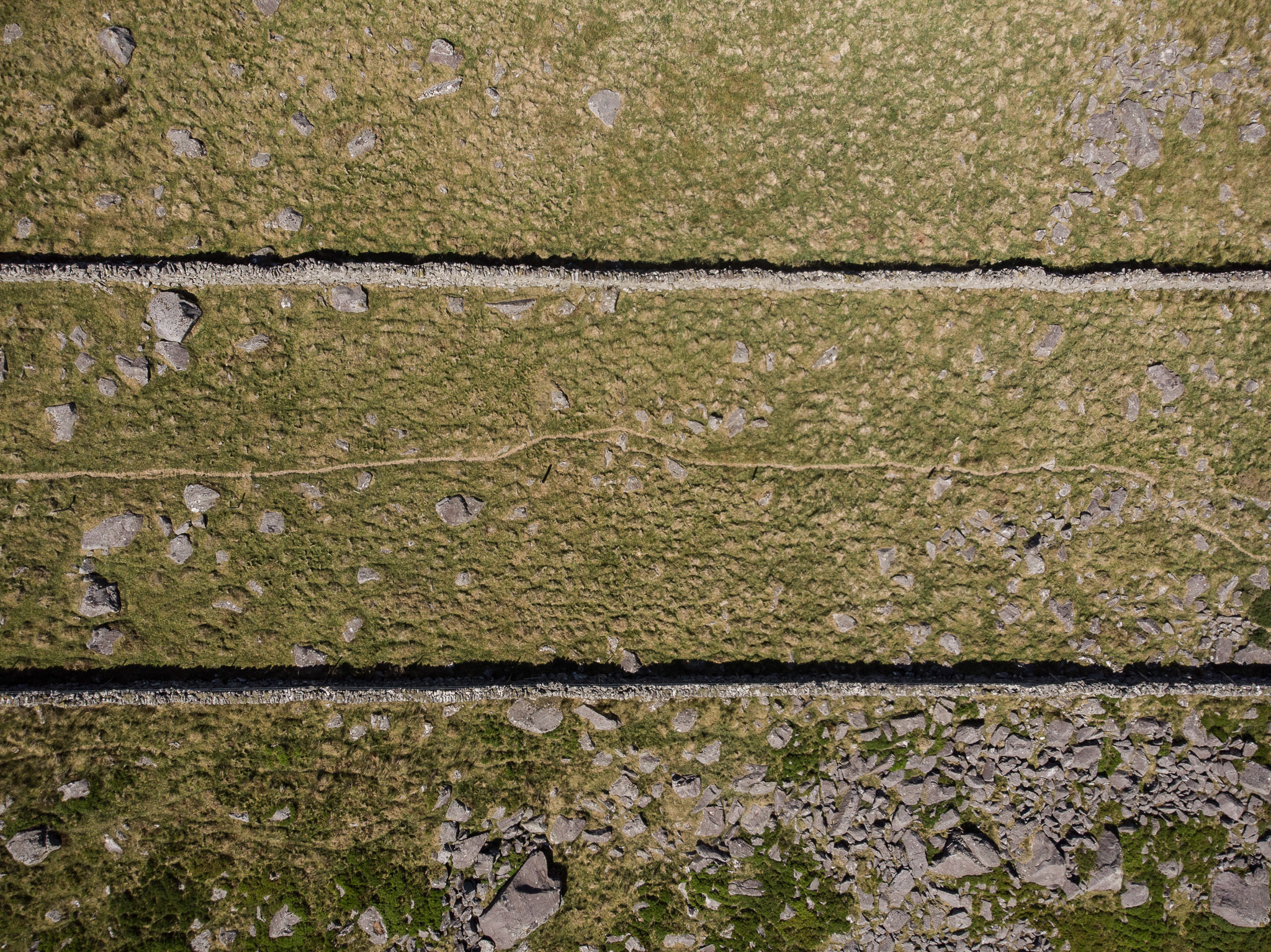
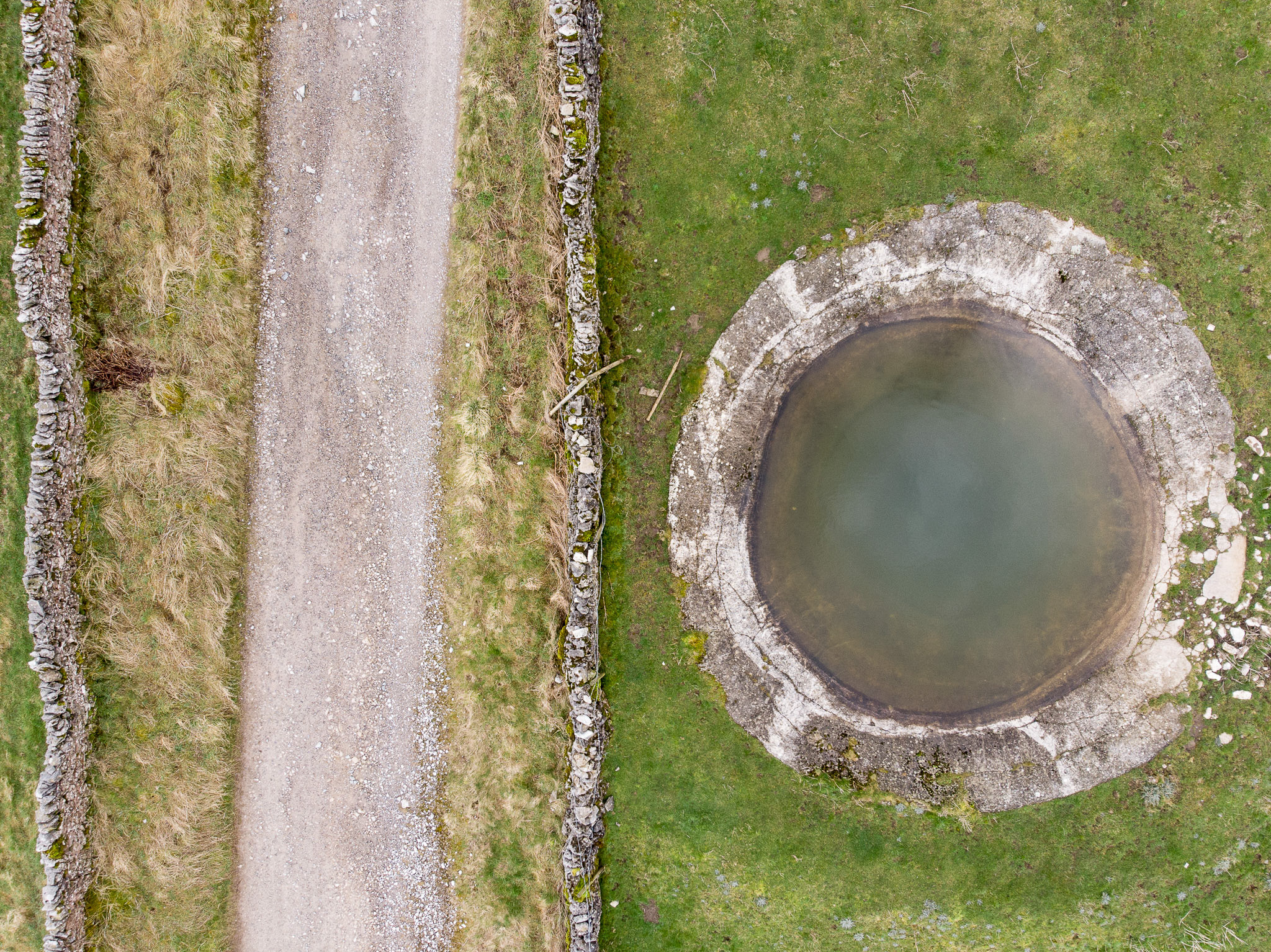
The breakthrough to my approach came on a trip to North Wales. I was walking in the hills above Taly-bont. As I descended the hills above Llyn Irddyn, I could see two perfectly parallel walls. In this wild isolated area, they just looked so incongruous. Why had someone bothered to take the time and effort to build these structures? From my vantage point high on the mountain I could see the image, but no matter which lens I selected, I couldn't frame the shot. As I descended the advantages of a high viewpoint were lost, at ground level I just couldn't make the picture work. It was lunch-time, so I pondered the problem whilst eating my sandwiches. Out here in this wild and barren place, was geometric evidence of man shaping the landscape, but with conventional photography, I couldn't get the photograph I wanted. What was needed was a high, controllable vantage point. The obvious answer was aerial photography, but hiring a light aircraft would have broken my budget!
A few years earlier I had used a drone for a project, this was the perfect solution. However, my experience of using drones was a frustrating one. I had built a couple of big drones, capable of lifting DSLRs off the ground. This was before 'off the shelf' versions were available. The problem was that I spent more time building and maintaining them than actually flying. In addition, with early flight controllers there was an ever-present risk, that your drone would develop a mind of its own and fly off into the sunset! In frustration I gave up. However, in the intervening time, a number of 'out of the box' solutions have become available. Whilst it was a bit of a gamble, I decided to try one out. A fortnight later I was back in the same area, flying a drone 80 metres above the walls. As soon as I saw the images, I knew I had found the solution.
Whilst there have been a number of photographers that have used aerial landscape images, including Edward Burtynsky and Yann Arthus-Bertrand, their work explores shape and form in a more ambiguous way. When writing about Burtynsky’s work in the Washington post, Columnist David Segal is quoted as saying, "Do Ed Burtynsky’s Photos Glorify Industry or Vilify It?". When asked about his own images, Burtynsky responds, "I don’t want to be didactic. I’m not trying to editorialise and say this is right or this is wrong. Either extreme is too simplistic". My work has evolved from a different heritage. An approach shaped by artists such as Richard Misrach, highlighting the ecological damage caused by the military on the American landscape (Bravo 20) and before him photographers from the New Topographics movement, whose images focused on a Man-Altered Landscape. This is work that is issue based. Whilst the images use composition and aesthetic forms, to draw in the viewer, their ultimate aim is to go beyond that and act as a catalyst to stimulate debate about contemporary and future land use.
Thinking back to my experience at the Camera Club, Geoff became my target audience. I wanted to create a set of images that would be appealing aesthetically, but would make people think about what they were seeing. I suppose that with a background in Social Documentary photography, it is not surprising that my landscape work is issue based as well. Using drones is just one way to achieve these goals.